
Of Ridge and River
Five Weeks Documenting the Wilderness of Alabama
Part I: Shifting Horizons
The perspective from a canyon edge is rarely won without a steep descent. When orders came down for the five-week-long Squadron Officer School at Maxwell AFB in Montgomery, Alabama, my initial reaction was entirely devoid of artistic romanticism. I was dreading it.
To leave behind my family (which would include the first time being away from my 10-month-old daughter), to miss the peak of an irreplaceable Colorado springtime, and to trade the crisp, high-altitude air for the heavy, suffocating blanket of Southern heat and humidity felt like an exile from the landscapes that fuel my work. Plus, the thought of five weeks of training that’s not applicable to my career field, standardized classrooms, and mandatory “fun” was an immediate source of friction.
But art, much like utility, is defined by the labor we are willing to invest into our circumstances. Perspective changes everything.
As the initial annoyance of the course settled into a predictable routine, a quiet, familiar counter-current began to take hold. Beneath the dread of the Southern summer, a genuine excitement began to build. I realized I wasn’t just going to Maxwell; I was returning to a highly specific regional geography that I knew possessed hidden, fractured depth. And so, instead of staring at the walls of a temporary military lodging facility, I chose to look at a map. Back during my time at JAG school in 2022, I had spent free weekends tracking down local waterways and tucked-away hollows, discovering that the state’s topography was far more complex than the highway maps suggested.
This wasn’t a five-week sentence in the humidity: it was a rare, hard-won window to to execute a targeted photographic campaign. The prospect of retracing my steps to familiar falls, combined with the thrill of hunting down entirely new, undocumented drainages, completely flipped the script. True landscape photography is rarely about finding the perfect, pristine destination; it is about applying a relentless willingness to see the extraordinary in the overlooked. Armed with a renewed attitude and a trunk full of camera gear, the entire experience shifted from an obligation to an adventure.
Part II: The Fall Line and Pre-Dawn Fortitude
Moffitt's Mill: An Unexpected Scene
My first opportunity arrived with the weekend. While scouring digital topographical maps and tracking historical water markers, my eye caught a minor, unassuming geographic tag: Moffitt’s Mill. Recognizing the regional geology and the proximity to the Fall Line - the ancient boundary where the hard, metamorphic rocks of the Appalachian foothills drop off into the soft sediments of the coastal plain - I suspected a waterfall had to exist in that depression.
Public information was virtually non-existent. The few Google reviews available were scarce, accompanied by low-resolution, poorly composed snapshots that did the falls no justice. Pictures made the scene appear to be nothing more than some rapids or a shoal along a relatively flat expanse of Little Uchee Creek. However, curiosity got the best of me, and I made the decision to head out the next morning and see for myself what awaited me.
To make matters more complicated for a landscape photographer, the weather forecast was an absolute nightmare for long exposures: clear, blinding skies without a single cloud to diffuse the harsh southern sun.
Determined not to let the sky dictate my output, I woke well before dawn, throwing myself into an hour-long drive eastward, through the Tuskegee National Forest and into the fading dark.
I arrived just as the first grey light began to separate the trees from the sky. The morning sun had not yet cleared the horizon line, leaving the small gorge cast in a soft, even shadow. Slipping past a narrow trail, the immediate signs of human presence were impossible to ignore. This was clearly a local summer swimming hole.
Names were aggressively carved into the ancient bark of beech trees, faded spray paint marred the native rock faces, and discarded trash littered the margins of the path. It is a frustrating, exhausting reality: the casual desecration of fragile ecosystems.
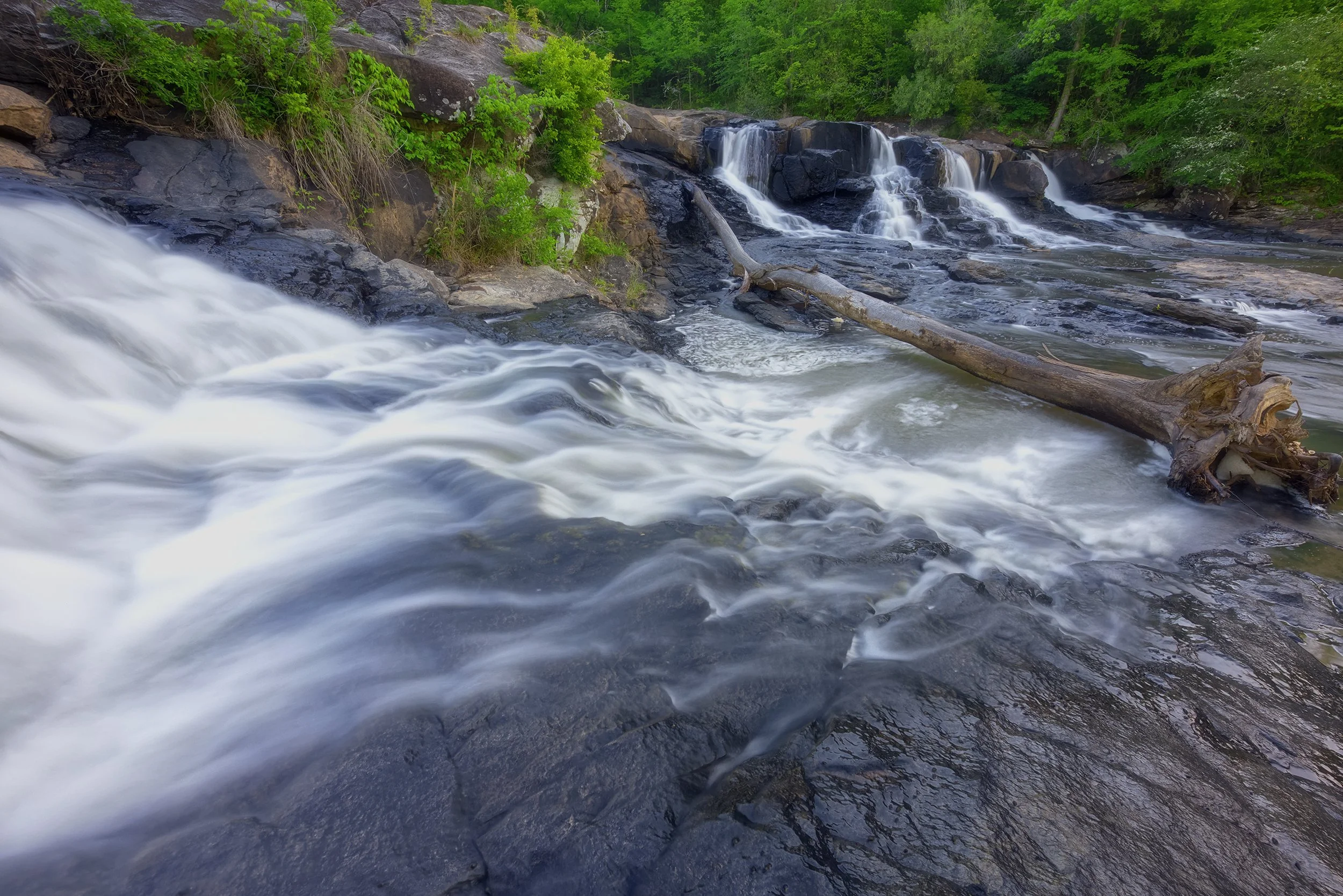
Yet, as I pushed down to the edge of the creek, the modern world dissolved. Before me lay the what few Google reviews titled “Great Falls,” a magnificent, raw expanse of water rushing violently over jagged, multi-tiered rock shelves. The sheer roar of the water was absolute, completely drowning out the ambient noise of the nearby roadway and the waking world.
The air held a sharp, bitter chill - holding steady at 45°F, a temperature I instinctively knew would be the final cold morning of my entire month in the state. Thick, low-hanging mist swirled aggressively over the surface of the creek, rising in ethereal columns before completely dissolving the moment it touched the canopy's early sunlight.
Southern Flow, 16mm | 1 sec., f/13, ISO 1600
I spent over an hour embedded in that creek bed, testing compositions and searching for perspectives that omitted the hand of man. Clad in heavy waterproof socks, I stood calf-deep in the current, feeling the icy, unrelenting force of the water rushing past my ankles, bracing my tripod against the slick river stones to capture the fluid grace of the tiers against the static strength of the rock.
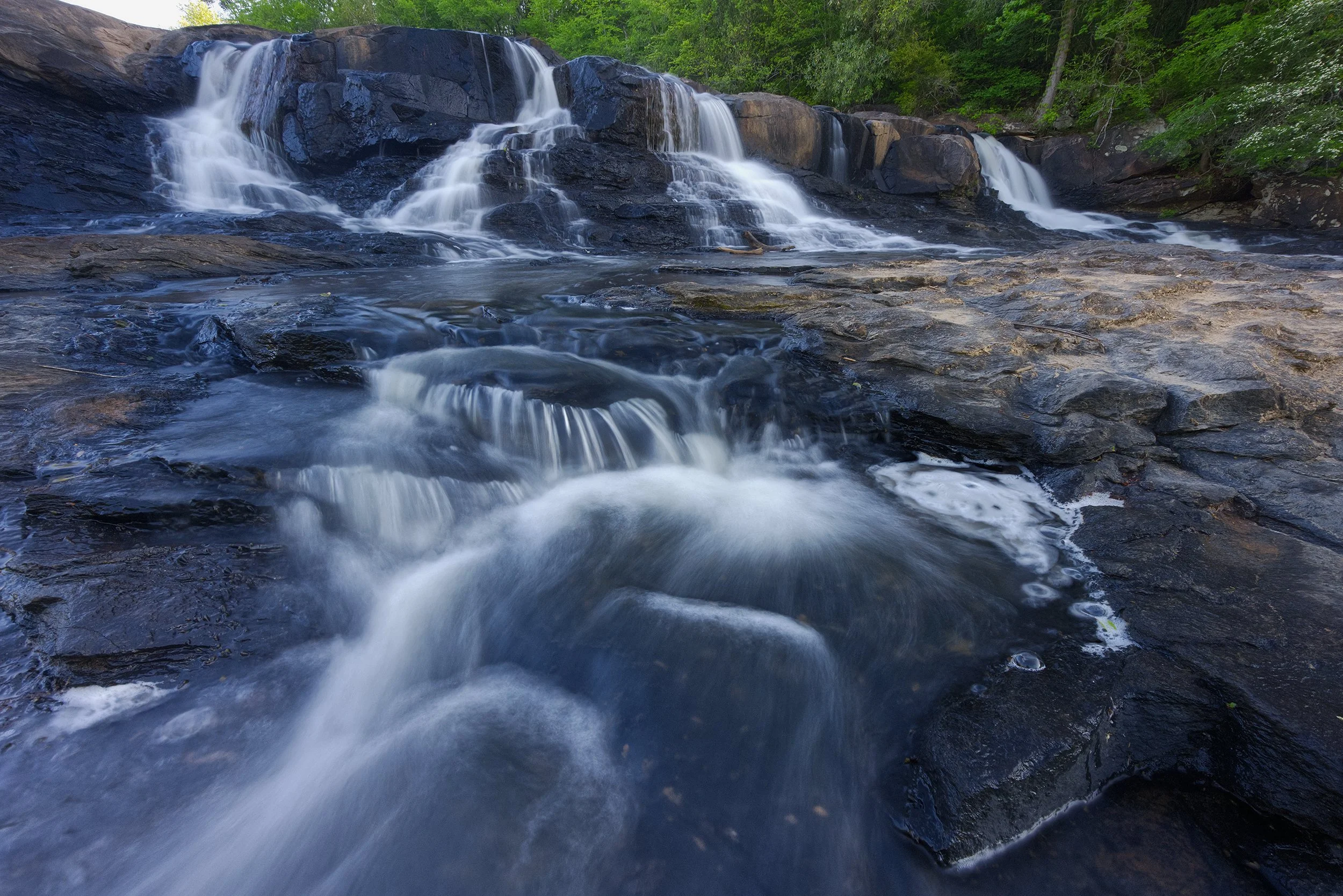
Cascades on the Fall Line, 16mm, focus merged | 0.6 sec., f/9, ISO 1600
Part III: Deep into the Land of a Thousand Waterfalls
The Deep Refuge of Bankhead National Forest
After enduring another mandatory week of Air Force Captain summer camp, the second weekend arrived with far more cooperative conditions. The sky hung low, laden with heavy, grey overcast clouds - perfect, uniform diffusion for high-fidelity waterfall exposures. Driving through the dead of night, the headlights sliced through the darkness of I-65 as I pointed the rental north toward the Bankhead National Forest.
Bankhead is an ecological anomaly, a sprawling scenic refuge often referred to as the Land of a Thousand Waterfalls. Nestled within its borders is the Sipsey Wilderness, a rugged, heavily fractured plateau carved deep by centuries of aquatic erosion. To those outside the immediate region, it remains a largely unknown and profoundly underrated wilderness area.
The landscape is defined by deep sandstone gorges, dense hardwood canopies, and a sheer density of hidden streams that emerge from the porous rock after any substantial rainfall. My objective for the day was ambitious: move fast, hike hard, and document as many distinct falls as the light allowed.
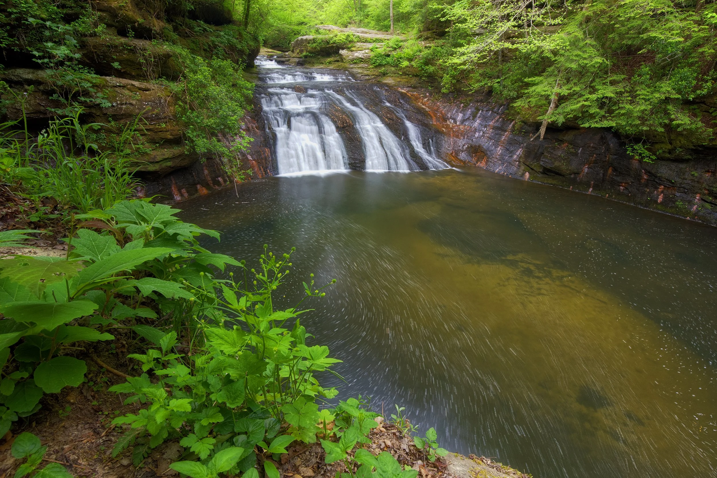
Kinlock Falls: Ancient Shadows and Local Ropes
Deep in the Forest, 20mm | 3.2 sec., f/13, ISO 800
I arrived at the first location shortly after sunrise. Kinlock Falls sits in an area steeped in human history; for centuries, Native Americans used these deep, overhanging rock shelters for protection, living off the rich biodiversity of the Sipsey basin long before European settlement. Parking on the shoulder of a narrow, gravel road, I made my way down a set of crude wooden steps into the forest.
The sound of running water was present throughout these woods. The steps led to a small, worn trail. From there, I could see the top of the falls, with the water of Hubbard Creek rushing past towards the precipice.
Much like Moffitt's Mill, the hallmarks of local summer recreation were present - thick nylon rope swings hung from heavy oak limbs, suspended over the dark, cool waters of the gorge bowl below. Yet, the ambient energy here felt significantly wilder, untamed, and ancient. I screwed on my filter system, which combines a circular polarizer and neutral density filters, and captured the sweeping, wide-angle rush of the cascade. I sat there for a few minutes, listening to the sounds of the forest and looking for unique perspectives. After some time, I quickly ventured back the way I came and returned to the car. The day was young, and the trail was calling.
Caney Creek Falls: Behind the Veil
The next destination required navigating a gravel path down a private road, where the makeshift trailhead sits adjacent to a weathered, dilapidated homestead. After depositing a small parking fee into the drop box, I began the steep descent into the gorge toward Caney Creek Falls.
The sensory transition was immediate. The humid air was thick with the songs of native birds darting through the upper canopy, their calls punctuated by the dry rustling of leaves overhead, the steady creaking of ancient timber, and the distant, rhythmic murmur of moving water.
Towards the end of the trail, I passed an isolated, primitive campsite resting just above the precipice of the main falls. I couldn’t help but think what a beautiful spot it would be for a night under the stars. Clambering down the steep, slick mud of the gorge walls, I dropped directly into the massive stone bowl surrounding the falls.
As if right on cue, the overcast sky broke, and the sun began to pierce through the trees - a frustrating development for long-exposure work, as it introduced harsh, blown-out highlights on the white water.
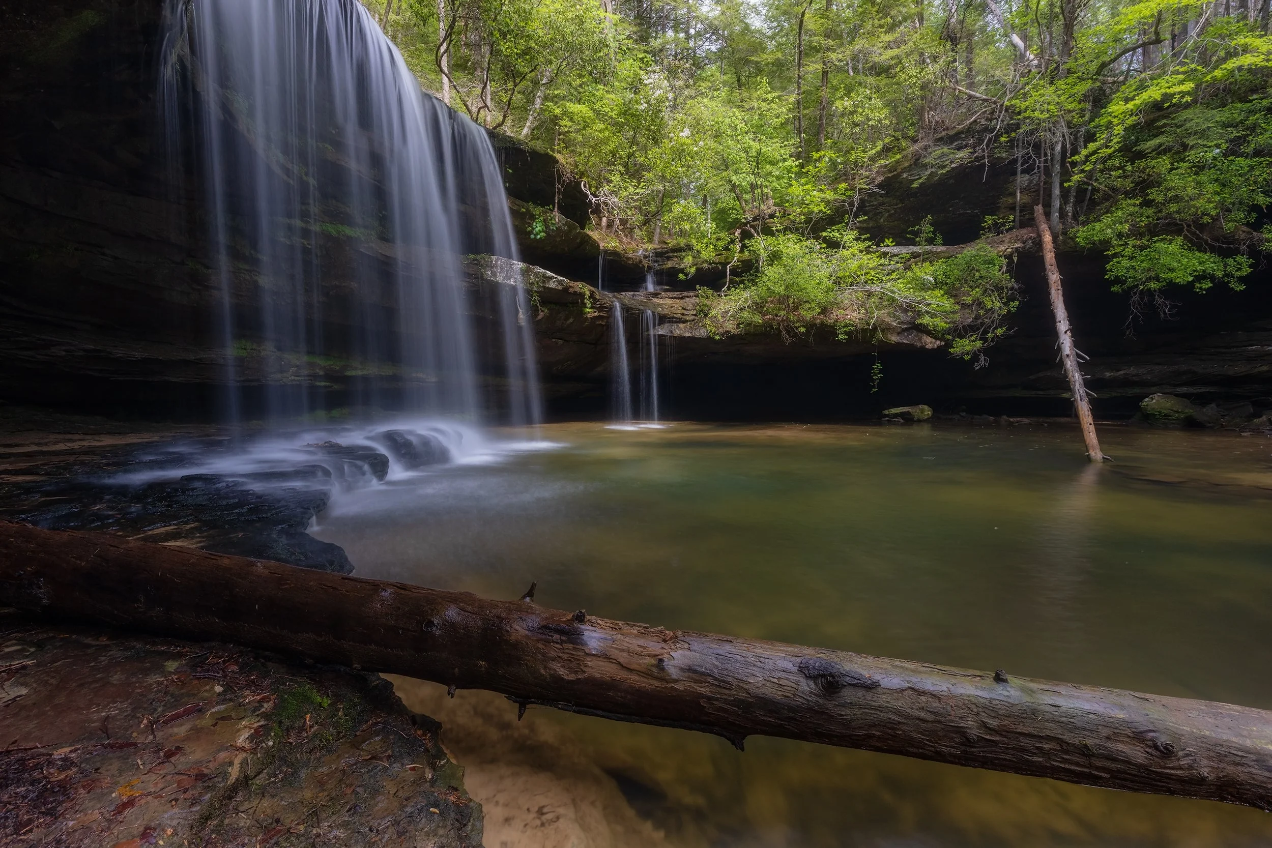
Adapting to the conditions, I shifted my focus away from standard compositions. I toyed with my Insta360 action camera, playing with dynamic perspectives, and walking into the amphitheater directly behind the heavy veil of the falls. Standing in the cold, soaked cave behind the roaring curtain of water, watching the light refract through the continuous downpour, the frustration of the sun melted into pure appreciation for the sheer engineering of nature.
I still managed, despite the conditions, to take this shot of the falls in a brief period of cloud-cover.
Behind the Veil, 16mm | 1.3 sec., 1.6 sec., & 2.5 sec., HDR merged, f/13, ISO 800
Mize Mill Falls: Trusting the Local Knots
A short drive brought me to Mize Mill Falls. While the hike from the roadside pull-off is incredibly brief, it is easily one of the most perilous entries in the region. To reach the bottom, you are forced to navigate a near-vertical, 40-foot drop down a slick clay bluff, relying entirely on a series of weathered ropes tied off to exposed tree roots by anonymous locals. Down there, you choose to trust the knot-tying skills of total strangers, or you don't go down. Which is basically the stuff we’d been doing at Squadron Officer School anyways, so I took my chances and rappelled down.
Descending hand-over-hand, I reached the cool, heavily shaded floor of the gorge. The air was noticeably dropped in temperature, insulated by the massive rock walls. The waterfall trickled gracefully over an intricate series of ledges.
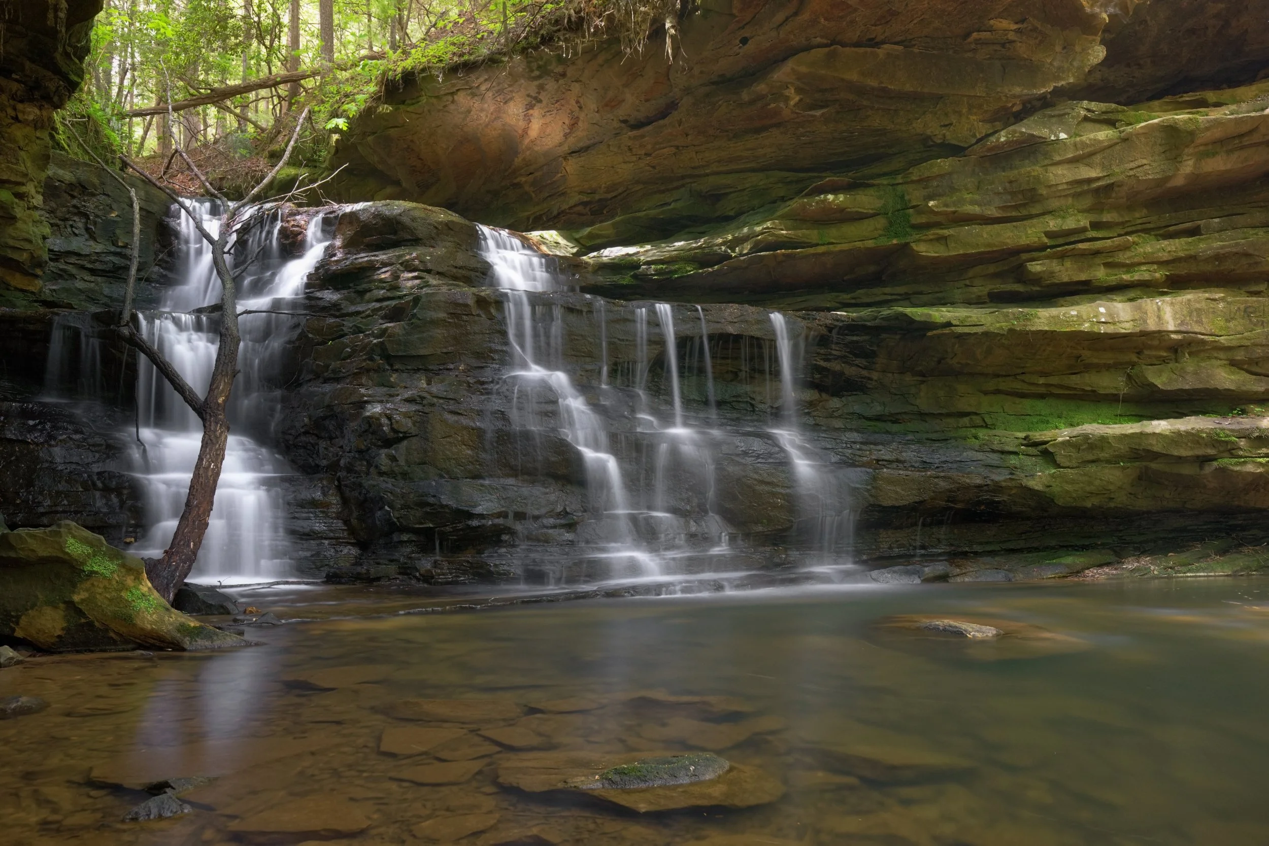
Morning in the Sipsey Wilderness, 22mm | 5 sec., f/8, ISO 1250
A couple was in the middle of a formal portrait photoshoot when I arrived; in a space this tight, etiquette is everything. We coordinated positions, shared the restricted stone shelves, and I managed to frame a series of tight, intimate compositions that captured the delicate texture of the flow.
The Sipsey Rejection and the Two-Mile Detour
Not every excursion yields an image. The trek to Fall Creek Falls demands a direct crossing of the sandy, slow-moving Sipsey River roughly a mile into the wilderness area. On this particular afternoon, with another complex hike still on the itinerary and the current running fast, I searched the banks extensively for an alternative, dry route across. Finding none, and unwilling to compromise my gear so late in the day, I made the calculated decision to turn back. In the backcountry, knowing when to call it quits is just as vital as knowing when to push.
That discipline was immediately tested at my final stop: Shangri-La Falls. The trail here is a chaotic tangle of overgrown brush, entirely lacking standard trail blazes or markers. Reaching an unmarked fork in the thicket, I chose the left path, descending sharply into the humid depth of the canyon.
It was an error that cost me an extra two miles of grueling navigation through stagnant, 85°F heat. When I finally hit water, the lack of recent rain had reduced the unnamed drainage to a pathetic, microscopic trickle. “This can’t be the falls,” I thought, as I looked for signs of recent activity. I tried to navigate the gorge a bit, crossing over slick stones and attempting to find footprints. Other than a long-forgotten fire ring, there was nothing.
Undeterred, I retraced my steps back to the original fork, took the alternate path, and dropped back into the gorge. Soon, the distant sound of voices confirmed I was finally on track.
The path was slightly treacherous - slick mud ran along a steep drop-off directly to my left, requiring me to once again hang onto local guide ropes and tree roots anchored to the hillside. Shangri-La Falls itself was barely running, though the deep pool beneath somewhat retained a shade of deep turquoise. It was a far cry from the images I had seen of this place, though.
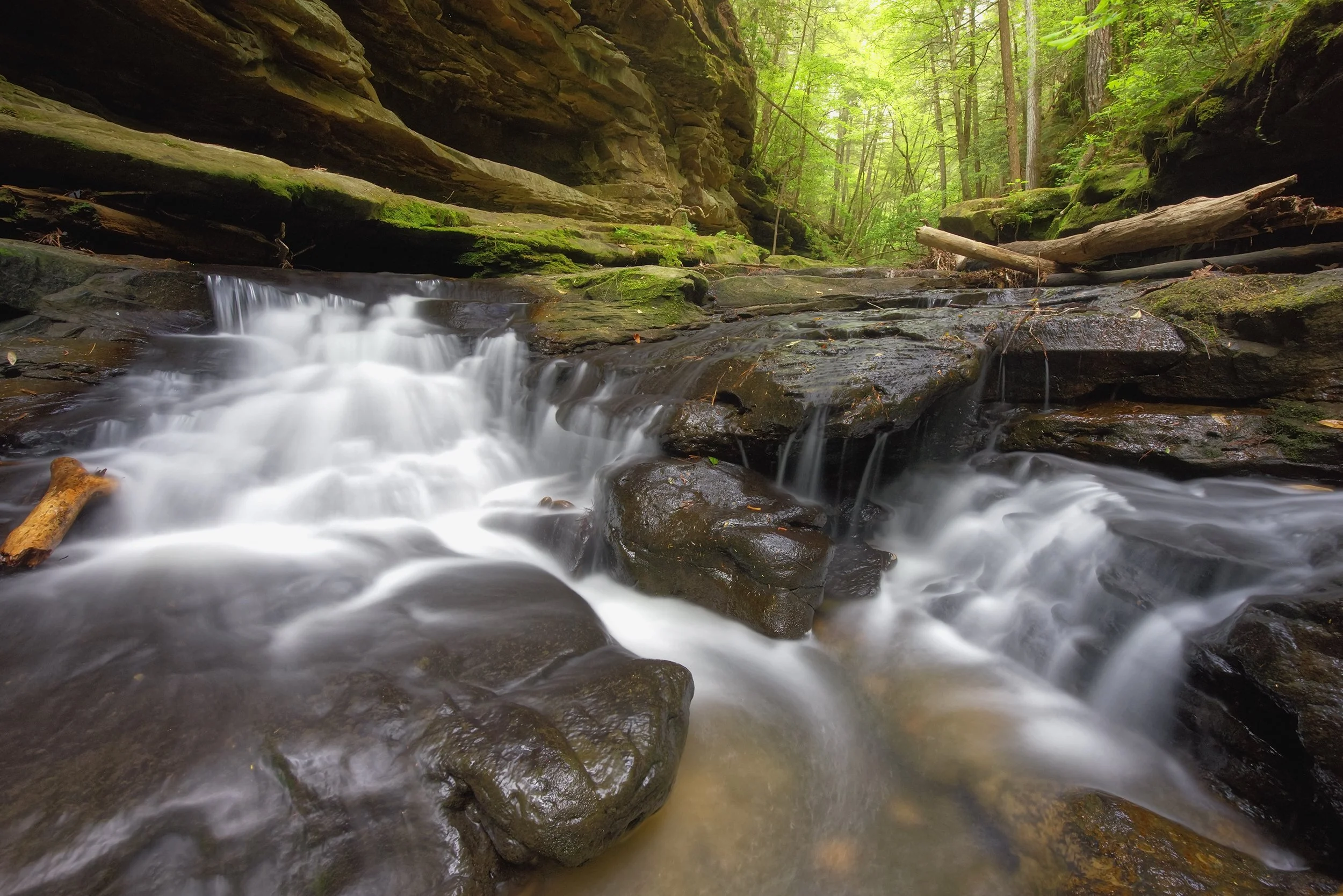
Land of a Thousand Waterfalls, 16mm | 3.2 sec., f/8, ISO 2000
I pushed further upstream, documenting a beautiful, subtle slide waterfall slicing through the stone. Eventually, the trail halted me at a sheer, slick 6-foot vertical rock wall. Burned out, drenched in sweat, and physically spent, I chose not to risk a solo climb with a heavy camera pack.
I turned around, navigated my way out of the dense thicket, and drove toward Birmingham for a well-earned plate of Hattie B’s Nashville hot chicken before heading back to base.
Part IV: Canyons in the Mist and Appalachian Ends
Little River Canyon: Dancing on the Edge
The following weekend, the sky broke open with a torrential nighttime downpour. As the rain pattered aggressively against my windshield, I drove through the dark toward the Little River Canyon National Preserve. By the time I bypassed Gadsden, the low pressure was forcing a massive layer of thick, heavy valley fog over the hillsides, creating a powerful illusion of scale - the rolling topography looked like a significantly taller range with only the dark crests piercing the mist.
Hoping to catch the fog before the morning heat burned it out of the canyon floor, I bypassed the standard northern entrance. I navigated a matrix of winding back roads, climbing higher into the northern reaches of the state.
I arrived on the canyon rim just after 8 AM. I was the absolute only person in the park. The air was rich with the scent of wet pine, damp earth, and that distinct, clean shine that only follows a severe summer storm.
Walking out to the edge of the stone overlook, the sight was breathtaking. Massive, dense clouds of mist were actively dancing within the deep chasm below, moving like a living organism, crashing against the vertical sandstone cliffs like slow-motion waves.
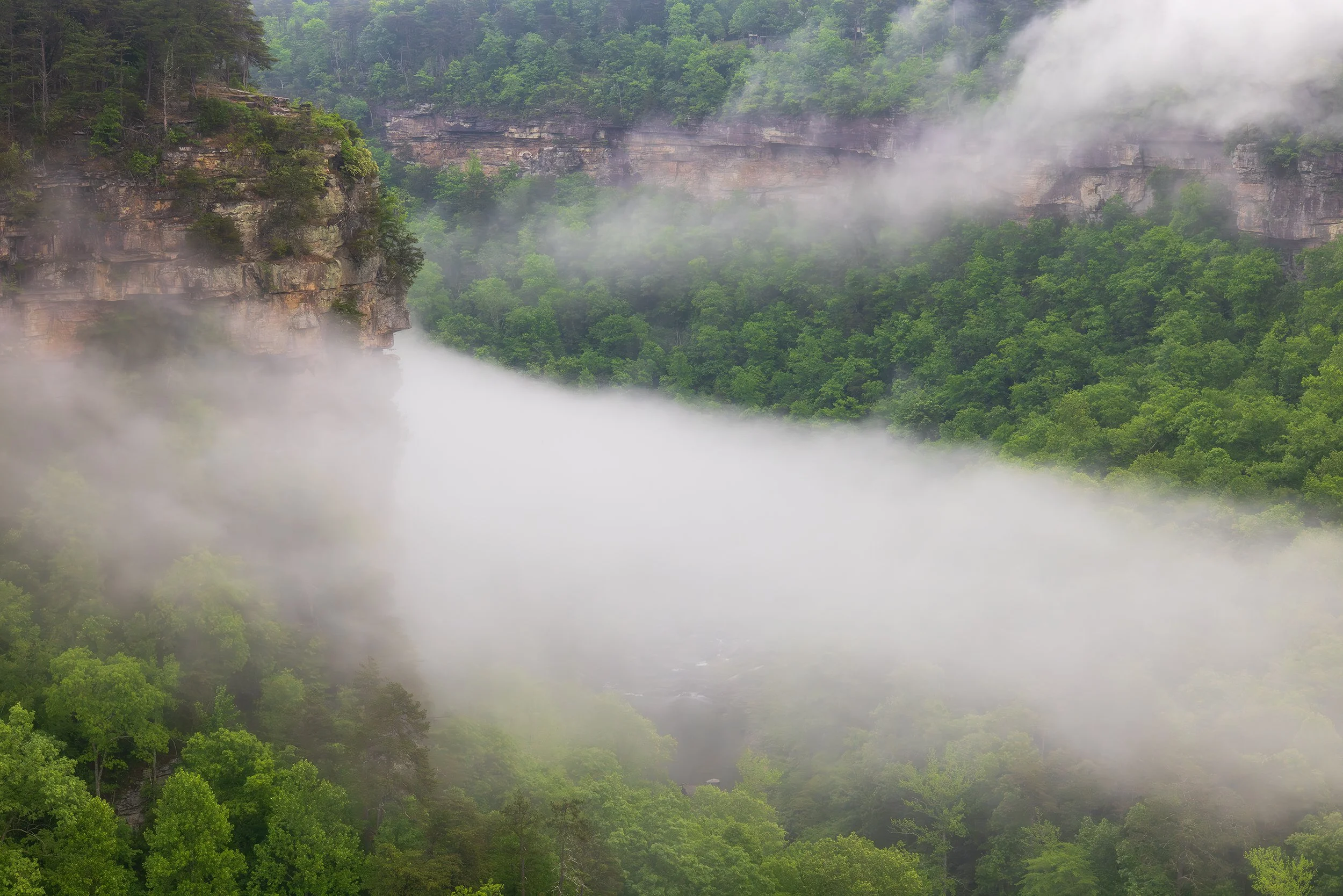
I moved deliberately from overlook to overlook, tracking the shifting light as the sun attempted to burn through the fog layer. It is easy to underestimate the sheer geography of this place until you stand on the unprotected margin; in several locations, the cliff face drops an absolute, unobstructed 600 feet to the riverbed below. Standing on those wet ledges with a powerful, unpredictable morning wind whipping out of the canyon was profoundly nerve-wracking.
Misty Morning, 70 mm | 1/160 sec., f/13, ISO 2000
Driving further down the rim drive, the raw reality of the storm became evident as I had to carefully maneuver the vehicle off-road to clear a massive hardwood tree that had been snapped across the pavement the night before.
I passed the tallest waterfall in the state - Grace's High Falls - which, true to the season and despite the recent rain, was nothing more than a silver thread tracing the massive cliff face.
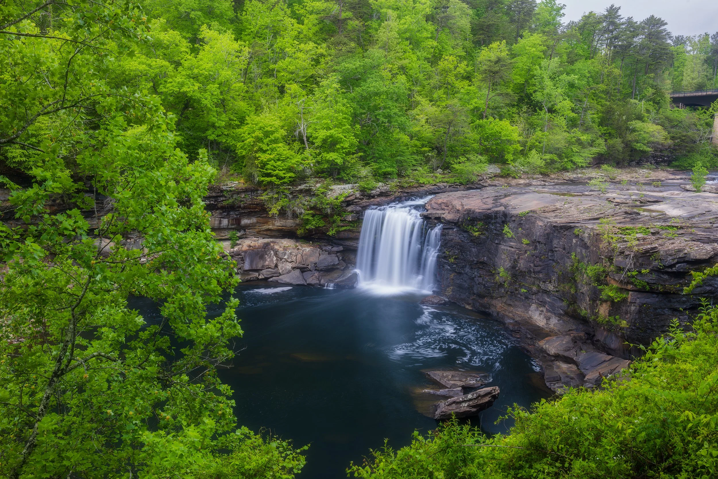
Eventually, I reached the northern terminus at Little River Falls. The water was flowing beautifully, but the park had completely renovated the viewing area since my last visit years ago. The old, wild access paths that once allowed photographers to walk out onto the exposed river rocks directly adjacent to the crest were entirely blocked off, replaced by a structured, safe wooden boardwalk. It is a necessary change for public safety, but a poignant reminder that the wild margins of our parks are continuously shrinking.
Rainy Day at the Falls, 35 mm | 10 sec., f/16, ISO 100
Cheaha State Park: The High Garden of the South
Faced with a clearing sky and dropping water levels up north, I abandoned my plans for Cloudland Canyon in Northwestrn Georgia and turned the vehicle back south, climbing into the rugged interior of the Talladega National Forest to reach Cheaha State Park.
Standing at 2,407 feet above sea level, Cheaha is the highest point in the state of Alabama. While that elevation sounds modest by Western standards, the topographic prominence is immense, rising sharply out of the surrounding flat expanse of the coastal plain. After flashing my military ID at the gate for free entry, I headed straight for the high ridges.
My first stop was the trailhead to Bald Rock. It’s a short, structured jaunt down an elevated wooden boardwalk. The view looks out over an endless, flat green horizon, offering minimal photographic value for my specific style, though I couldn't help but feel a smirk of athletic satisfaction as I easily paced past overweight Alabamans struggling for breath on a completely flat deck.
Next up was Pulpit Rock. This one was a far more rugged, unpaved trail that leads directly to a massive, exposed stone promontory. Here, the landscape opens up completely, offering an unobstructed view of the true southern terminus of the mighty Appalachian Mountain chain. I sat on the edge of the cliff for a long time, my boots dangling out over the empty air, listening to the wind howl through the stunted pines and watching massive birds of prey catch the thermal updrafts directly over the valley.
Finally, I sought out the Rock Garden, a treacherous, highly technical section of the ridge that I hadn't attempted since my undergraduate days back in 2018. Returning alone as a seasoned photographer felt like a strange closing of a circle.
I carefully located the precise, narrow stone footholds required to scramble down the face of the cliff toward a tight, wedged gap over the abyss. Bracing my weight, I leaped across the void onto a isolated, solitary pillar of stone that hangs precariously out over the entire valley.
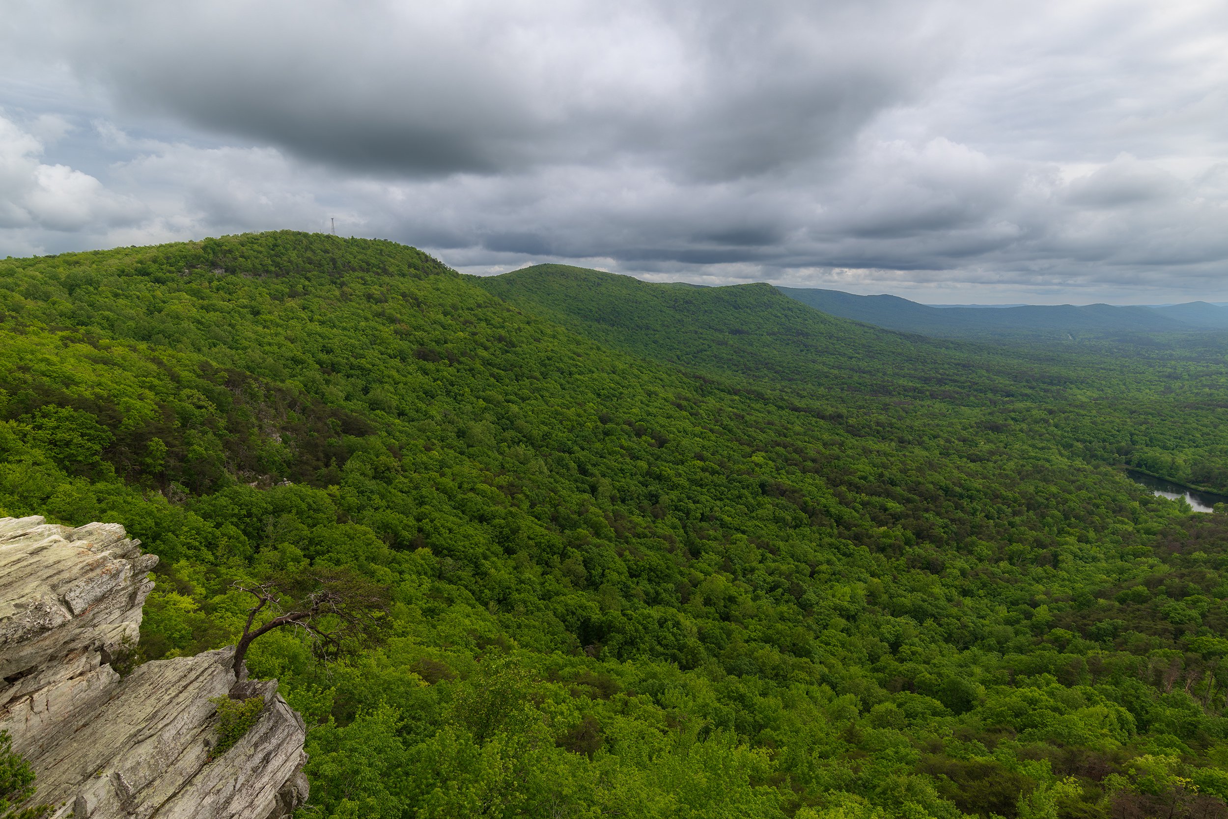
From this single perch, the view is undisputedly one of the finest in the entire state. Looking down at the distant gleam of Lake Cheaha far below, wrapped in the vibrant, neon green of budding springtime leaves and passing storm clouds rolling overhead, I was struck by the absolute serenity of the heights.
Top of Alabama, 22 mm | 1/100 sec., f/13, ISO 320
Landscape photography is a continuous exercise in visualization; sitting on that rock, I found myself mapping out the scene in my mind's eye, imagining how this exact valley would look cast in the fiery reds of autumn or the stark, skeletal whites of winter.
The lingering adrenaline from the Rock Garden leap slowly ebbed away as I navigated the final climb back to the car, my muscles burning from a day spent challenging vertical drops and slick shelves. It was the heavy, satisfying exhaustion that always accompanies genuine effort in the backcountry - the physical tax paid for the frames now locked onto my memory card.
Leaving the high terrain of Cheaha behind, I pointed the vehicle south, beginning the long descent back toward Montgomery in the fading afternoon light. Midway through the journey, the sheer physical toll of the day demanded a halt, and I pulled off the highway into Sylacauga for a plate of well-earned food. Sitting in a Chick-fil-a parking lot, watching the dust of the Talladega ridges dry on my boots while tearing into a heavy, unpretentious meal, I paused for a moment, letting the raw energy of the canyons and cliffs settle before crossing back through the gates of the Maxwell and returning for another week of Captain summer camp.
Part V: The Return to Bankhead
The Sipsey Redeemed
For my final weekend in the state, I wasn't alone. Two fellow Captains from the course, caught up by the images I had brought back to base, asked to tag along on a search for moving water. There was only one logical choice: a return to the depths of Bankhead. A massive system of rain had just rolled through the region, and I had high statistical hope that the water levels would finally cooperate.
Our side-gorge approach confirmed my suspicions immediately. Every minor, unnamed drainage was screaming with white water. This was, without a doubt, the true face of the Land of a Thousand Waterfalls.
The morning broke completely clear - cloudless and bright - which presented severe technical challenges for balancing exposures, but the temperature had dropped significantly, providing crisp, clean air for a long march. Reaching the banks of the Sipsey River, the water was running significantly higher and faster than the previous week.
Prepared for the obstacle, I stripped off my primary boots, slipped into specialized water shoes and heavy neoprene socks, and stepped into the current. The water was shockingly cold, rising well above my knees, the powerful force of the river bed current pushing against my legs as I carefully guided our group across to a slick, muddy wooden ladder tied to the opposing root bank.
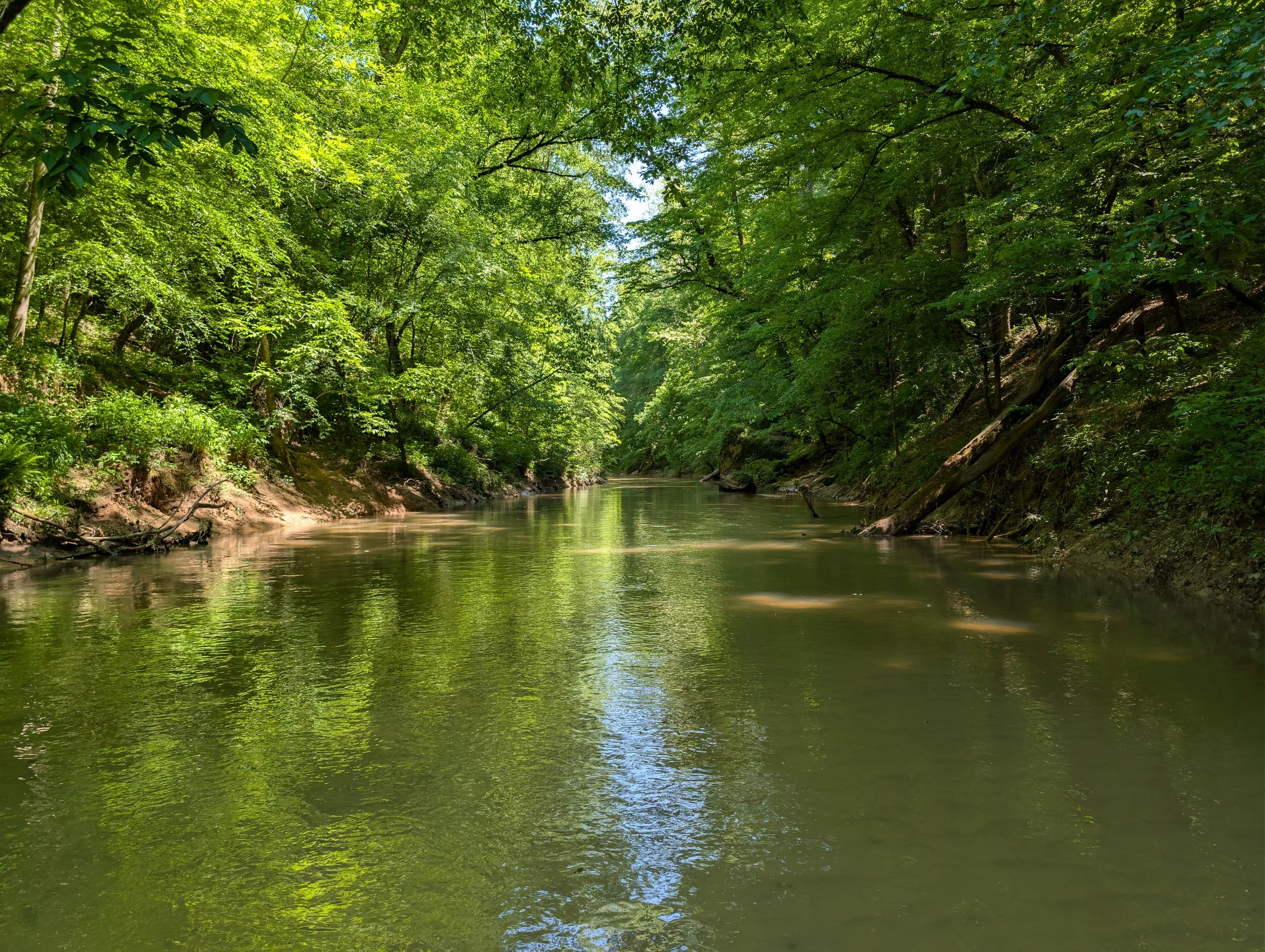
We tracked a minor tributary upstream, the heavy, rhythmic sound of falling water echoing through the trees long before the geology opened up. After some careful footing down exposed hemlock roots, we dropped into the hidden amphitheater of Fall Creek Falls.
The volume was immense. The water was throwing itself violently over the lip, illuminated by a harsh, direct morning sun that threatened to ruin the shot.
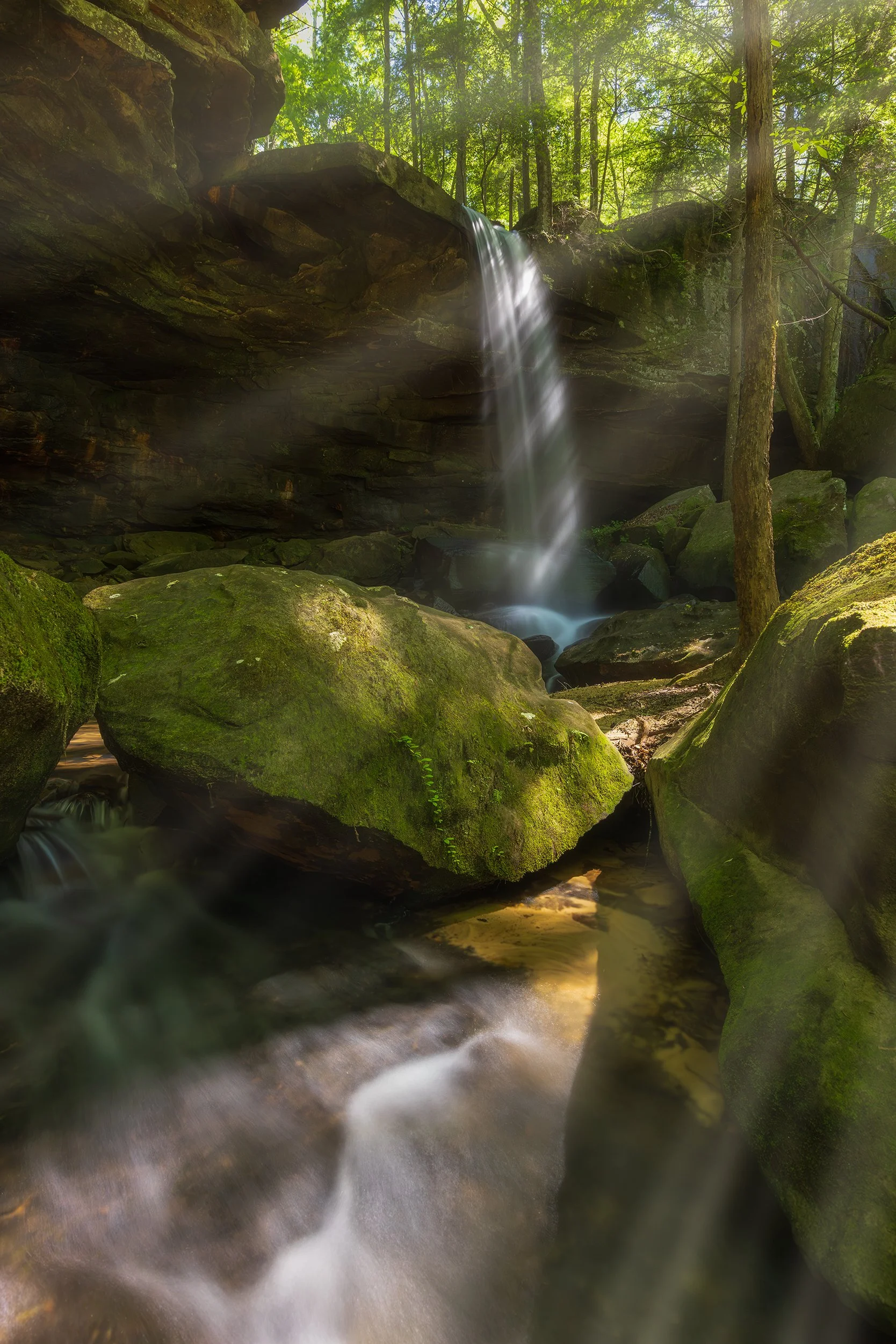
Field Note: Breaking the Rule of the Horizontal Landscape
True landscape photography demands adaptation over dogma. Faced with harsh, direct sunlight filtering through the canopy, I chose to shoot a highly compositionally restrictive vertical orientation - something I rarely do. By dropping into the icy spray of the plunge pool and framing vertically, I managed to hide the sun just beyond the upper right margin of the frame. This allowed me to capture the brilliant, defined rays of light slicing directly through the mist and scene, transforming a technically difficult lighting situation into a powerful, high-contrast narrative image.
Filtered Light, 19mm | 6 sec., f/11, ISO 1000
With the Sipsey safely crossed a second time, I guided the group back toward the hidden tracks of Shangri-La Falls. Knowing the layout of the forks, we bypassed my previous detour entirely, reaching the deep pool in record time. With the recent rainfall, the falls were operating at peak volume. The deep circular pool below had transformed into a striking, brilliant shade of clean turquoise, glowing intensely where the morning sun cut through the branches. We stood on the rocky margin in absolute silence, absorbing the cool breeze and heavy mist rolling off the plunge basin.
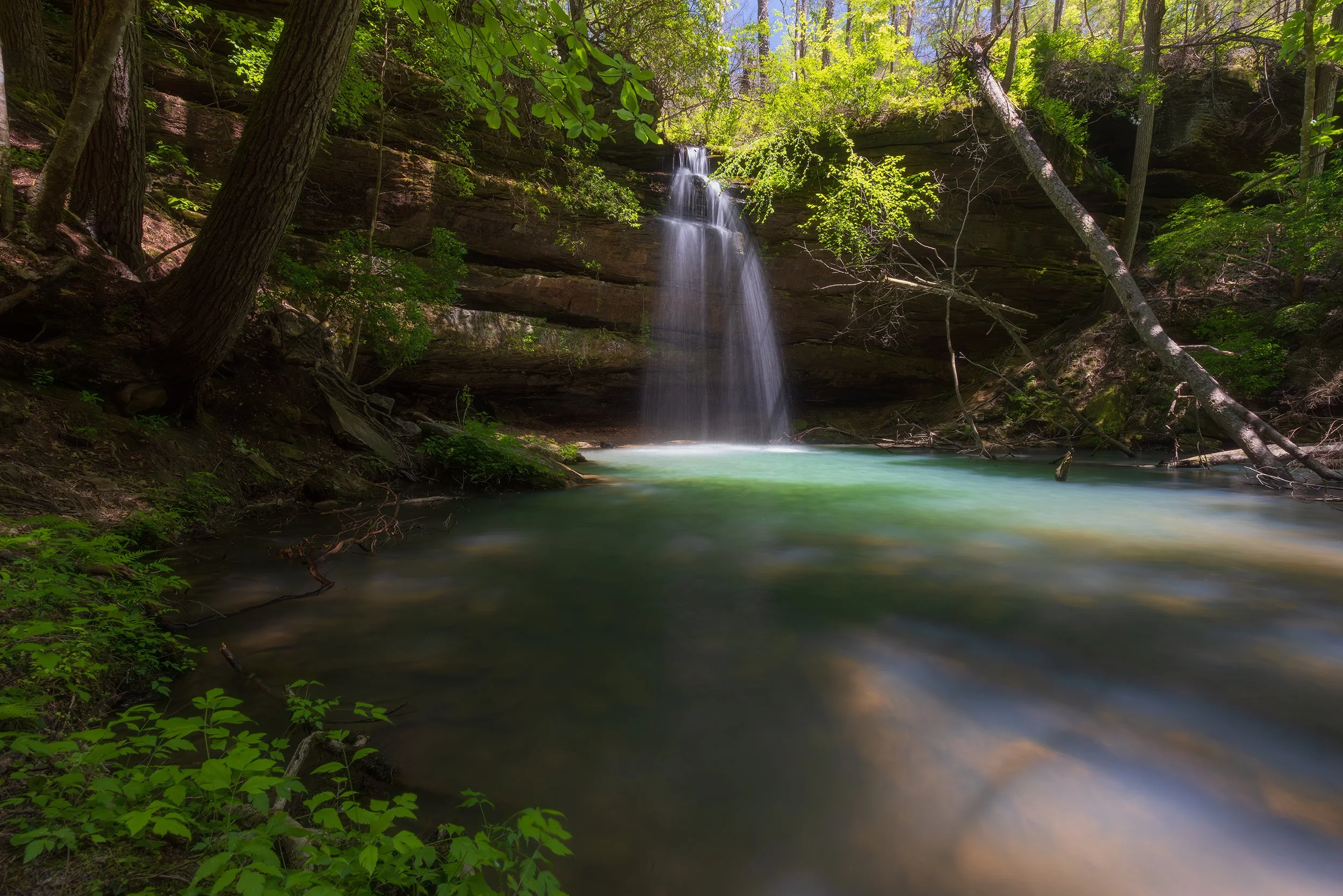
Alabama Paradise, 16mm | 1 sec., f/13, ISO 1600
Pushing past the 6-foot vertical wall that had halted my progress two weeks prior, we scrambled over the wet, moss-covered stone and advanced deeper into the untamed interior of the canyon. The gorge closed in aggressively around us, the massive sandstone walls looming overhead, creating dark, deeply recessed rock overhangs that felt entirely disconnected from the modern world.
Waterfalls were emerging from every fracture in the stone. The sheer sense of isolation was absolute and real. This felt genuinely wild - an incredibly underrated, completely misunderstood pocket of American wilderness.
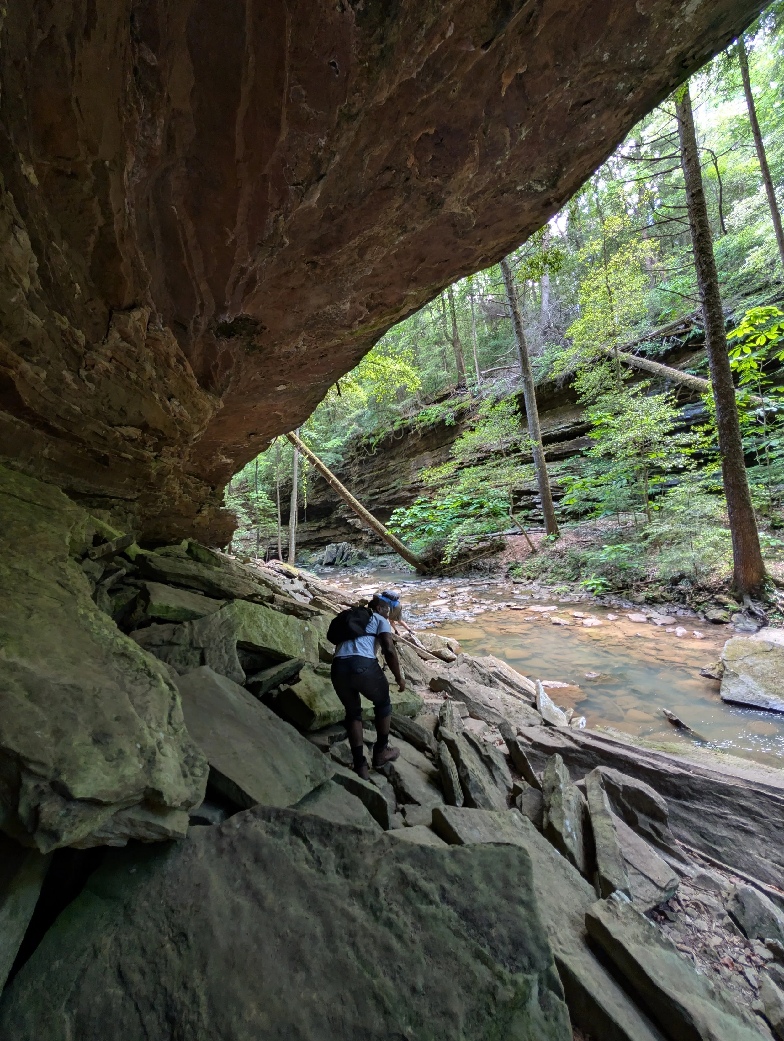
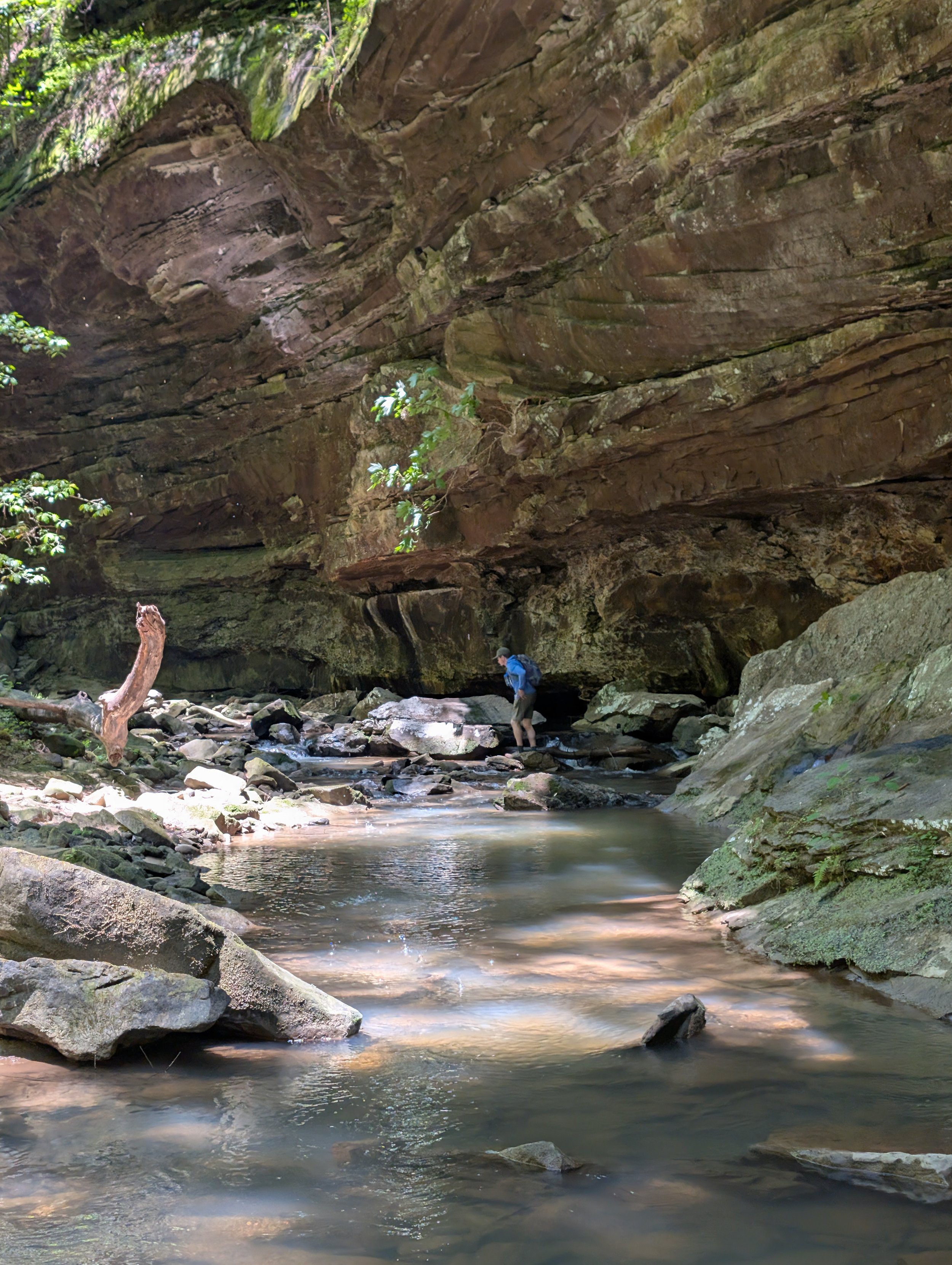
We cleared two additional, completely unnamed waterfalls, navigating the trackless gorge floor by balancing over fallen, rotting logs and leaping between wet, unstable stones before finally turning back toward the vehicle. We closed out the expedition the only way that made sense: a final stop in Birmingham for a heavy plate of hot chicken before returning for the last full week in Montgomery.
Part VI: The Value of the Unseen
The departure from a landscape you have thoroughly documented always carries a distinct emotional weight. Sitting in the window seat as the plane climbed out of Montgomery, the whine of the engines punctuated a deep sense of transition. Looking out over the wing, I watched the sprawling grid of Montgomery and the muddy, winding ribbon of the Alabama River shrink into the morning haze.
I felt the immense, magnetic pull of home - an undeniable eagerness to return to Colorado Springs, to see my wife and daughter, and to breathe in the sharp, dry air of the Front Range. My eyes naturally sought out the western horizon, longing for the jagged, uncompromising silhouettes of the Rocky Mountains.
Yet, as the aircraft leveled out above the endless, solid green carpet of the Southern canopy, I found myself struck by a profound, unexpected wave of appreciation for the territory below.
Overhead in the storage bin, my camera bag was packed with raw data: hundreds of frames that captured a wilderness most people fly right over without a second thought. I had entered this state full of resistance, yet I was leaving it creatively fulfilled.
There is a prevalent, uneducated cultural narrative that dismisses the American South as a flat, monotonous expanse of humidity and pine plantations. It is a reputation born of laziness - a symptom of an era where people prefer to consume landscapes through a digital screen rather than earning them through the physical expenditure of sweat and fatigue.
My five weeks in Alabama were a profound reminder that beauty is not a commodity reserved exclusively for the dramatic peaks of the West or the celebrated coastlines of the North. It exists in the damp, ancient silence of a sandstone gorge in Bankhead. It exists in the heavy valley fog dancing within the walls of Little River Canyon. It exists anywhere an artist is willing to wake up at 3 AM, trust their gear down a vertical cliff face, and stand shin-deep in an icy riverbed just to watch the mist rise into the morning sun.
The value of the landscape photography is directly tied to the wild places of the world. It takes a willingness to explore, a refusal to accept cookie-cutter expectations, and the fortitude to look past the spray paint and the trash to find the raw, ancient pulse of the earth.
Don't wait for the perfect destination. Pack the car, find a blank spot on the map, and go find the wild places hiding in your own backyard.
If you want to follow the journey behind the lens and receive deep, unfiltered field dispatches, gear breakdowns, and regional mapping guides directly from the backcountry, consider joining our community below!