
The Bluebird Curse: A 2,000-Mile Search for Scenes Across the American Southwest
They tell you the Southwest is a land of "eternal sun," but for a landscape photographer, that’s less of a promise and more of a threat. We spent a week chasing the horizon through Colorado, Arizona, and Utah, and while the miles were many, the clouds were non-existent. In the world of landscape photography, the "perfect weather" of a bluebird sky can be a disaster.
This wasn't a curated influencer trip. It was a week of 3AM alarms, a twice-sprained ankle, record-breaking heat domes, and the constant battle to find something profound in a landscape being bleached by a relentless, cloudless sky.
Day 1: The Detour that Started the Trip
We left Colorado Springs with the intention of making it to Durango by nightfall. But as we approached Great Sand Dunes National Park, the sky did something rare: it stayed clear, but for once, it worked. Usually, the Sangre de Cristo mountains are bashful each time I visit here and hiding behind a veil of clouds. But not today.
I took the 30-minute detour - a small price for a dream shot. I pulled out the 100-400mm lens. Most people think "wide" for dunes, but the real story is in the compression. From the highway, I could see the wind whipping sand off the crest of Star Dune, the highest in North America. With the snow-capped peaks providing a jagged backdrop against the dunes’ soft curves, I finally captured a shot I’ve been hunting for years.
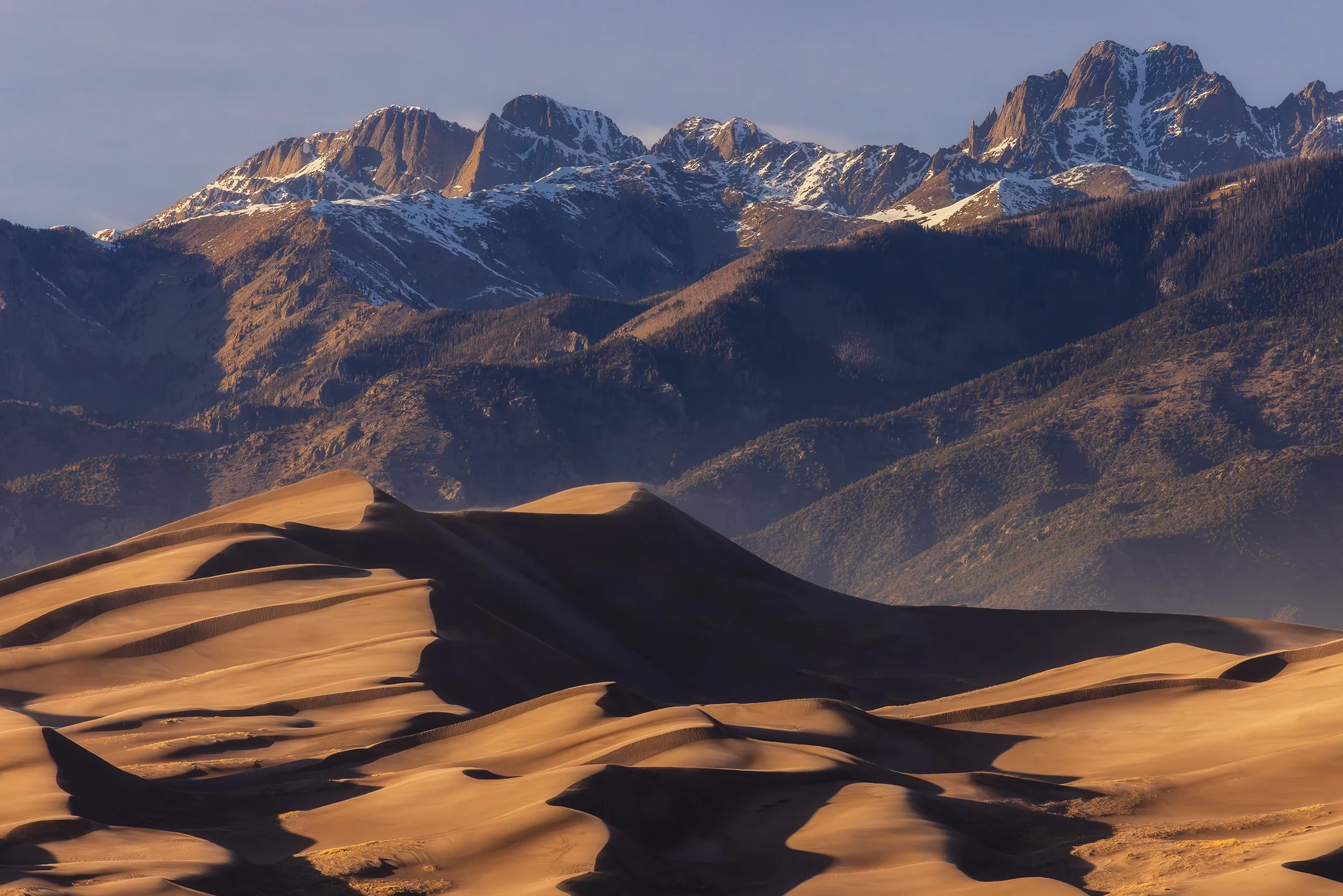
Canon EOS R5, 400mm | 1/400 sec., f/16, ISO 3200
Reflections on the Start: There’s a specific kind of internal conflict that happens when you nail a bucket-list shot in the first few hours of a 2,000-mile trip. Part of you wants to just turn the car around, go home, and pour a drink because you’ve already peaked. The other part - the obsessive part - starts worrying that you’ve just used up all your luck on day one. Despite these thoughts, night was falling and we continued on to our original destination with excitement for what was yet to come.
Day 2: Ancient Shadows, Time-Zone Tetris, and the Sacred Red
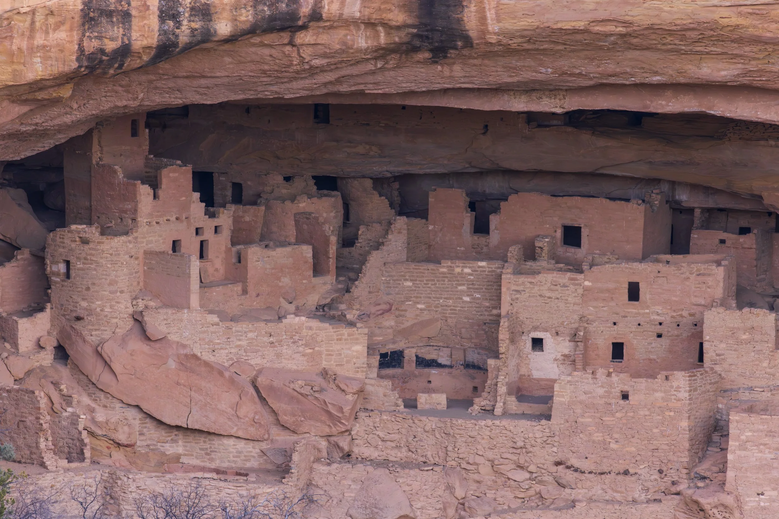
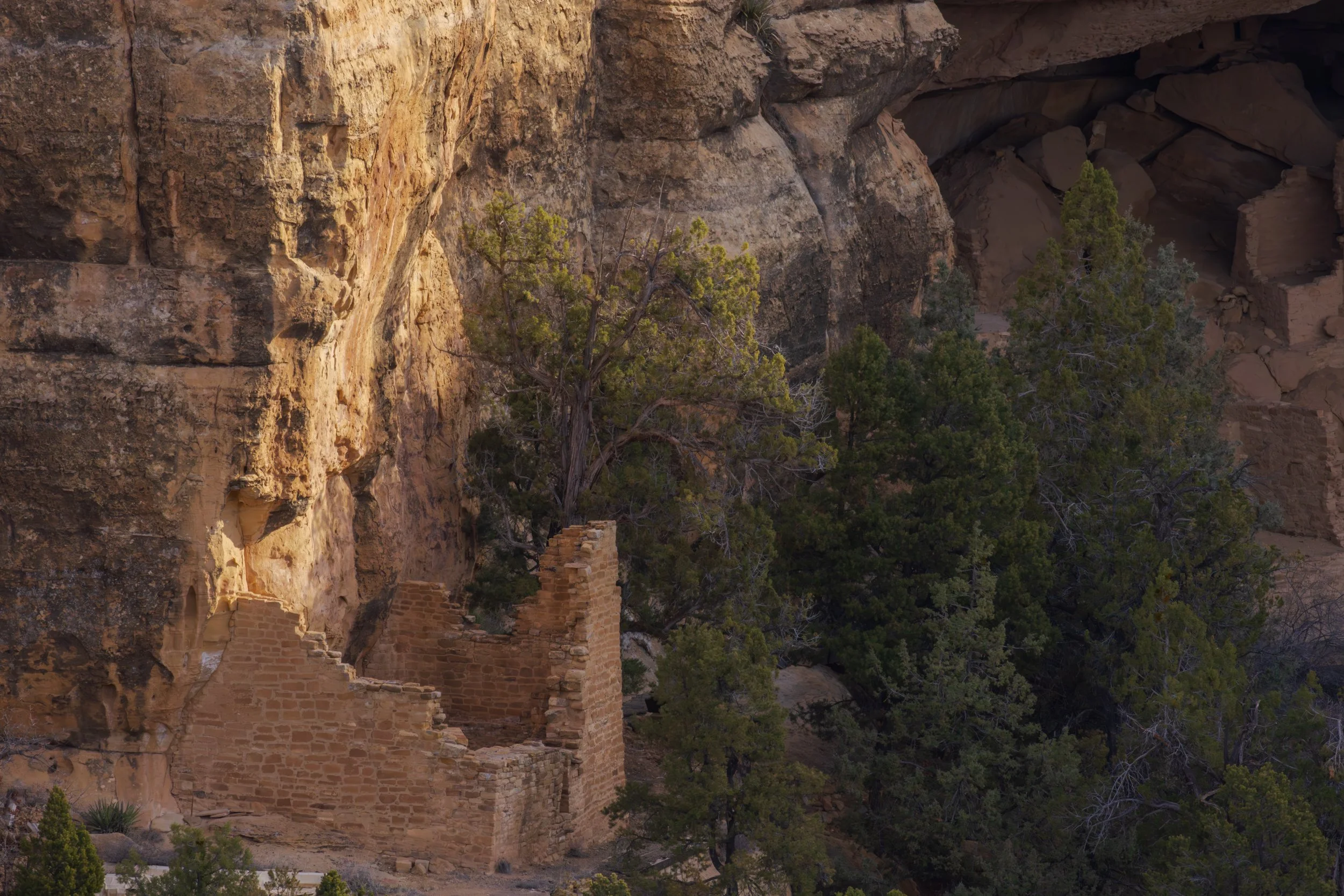
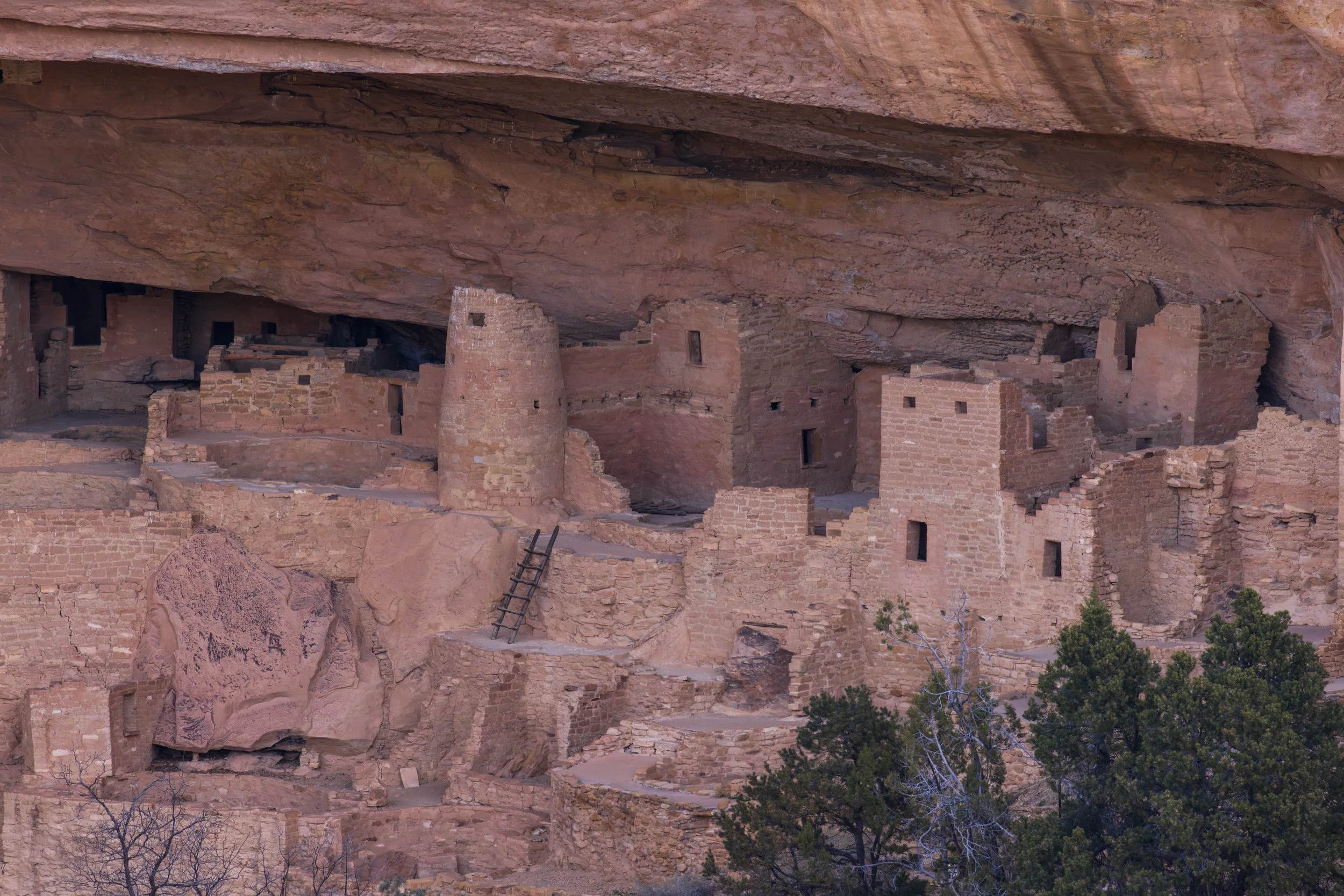
Morning came early in Durango as we pushed toward Mesa Verde National Park. Standing at the overlook for Cliff Palace, you aren't just looking at rocks; you’re looking at a 700-year-old mystery.
In December 1888, two cowboys were out searching for lost cattle during a snowstorm. They peered over the edge of the mesa and saw, through the swirling flakes, an entire city carved into the sandstone alcove. Imagine that moment - expecting a stray cow and finding a civilization.
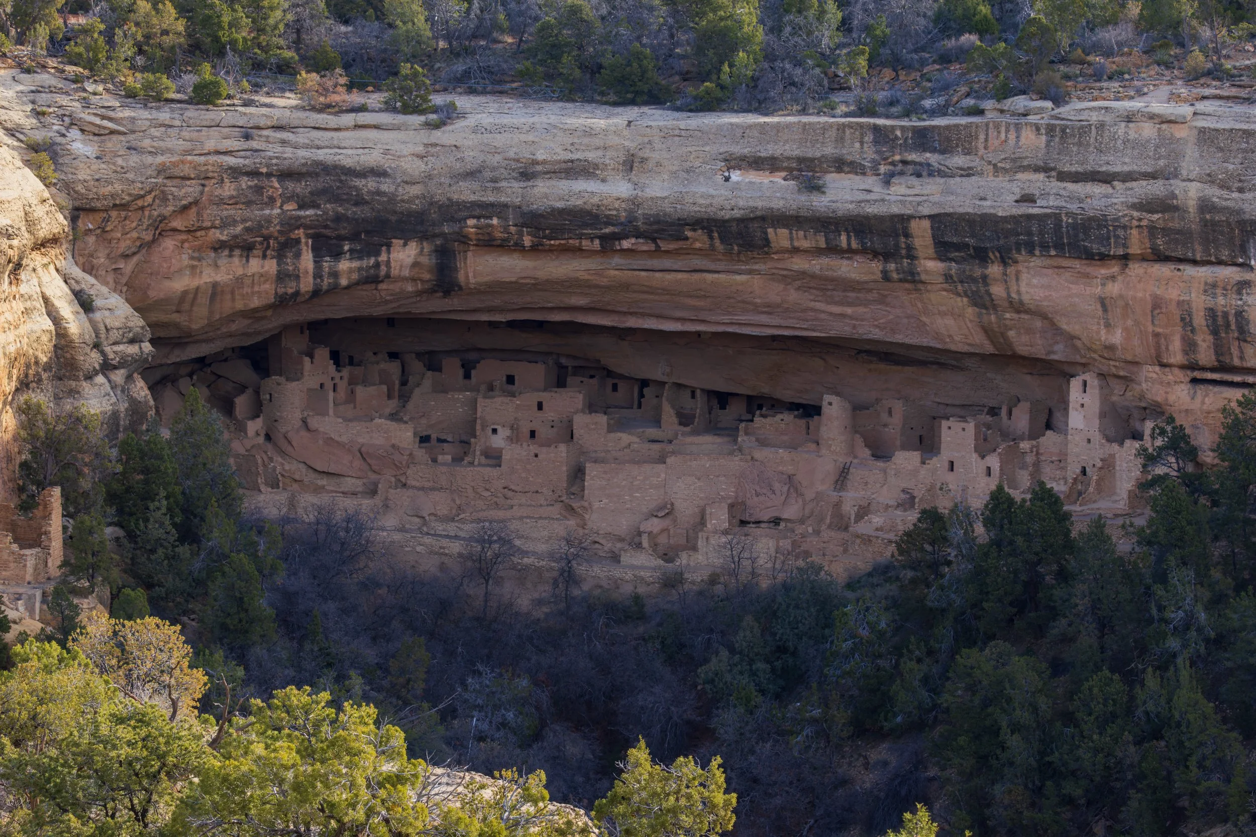
Standing there, I tried to strip away the paved roads and the visitor center in my mind. When those cowboys saw this through the haze of a storm, it must have felt like stumbling into a ghost story. Looking through the 100-400mm, focusing on the soot-stained stones of the kivas, you realize these aren't just "ruins." They’re an echo of a life lived in total harmony with the stone. It makes my modern life feel incredibly fragile, knowing that these walls and ladders hold secrets and memories that have stood the test of time.
Canon EOS R5, 100mm | 1/125 sec., f/18, ISO 500
The Navajo Time Warp
After a quick stop at Four Corners, we crossed into Arizona, where the trip hit its first logistical snag: Navajo Nation Time. If you’ve ever driven through the Navajo Nation during Daylight Savings, you know the feeling of your car’s clock and your phone’s clock engaging in a heated argument. We lost and gained hours like pocket change, to the point where we didn't really know what time it actually was anymore. This ended up being quite the nuisance in planning for travel times and the time of sunset, as we weren't sure how much time we'd have to kill before the sun dipped below the horizon.
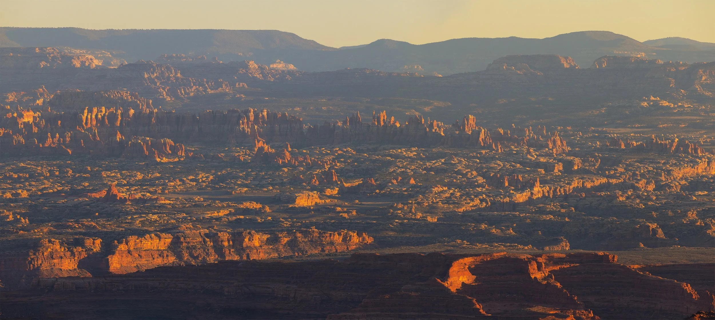
We ended up in Utah earlier than expected, so we hit Valley of the Gods. This 17-mile dirt loop winds past massive sandstone buttes - like a miniature, un-policed Monument Valley. I flew the drone here, watching as my CX-50 kicked up dust against those ancient towers. It provided a birds-eye perspective that human eyes weren't meant to have, turning the rugged road into a ribbon of red silk.
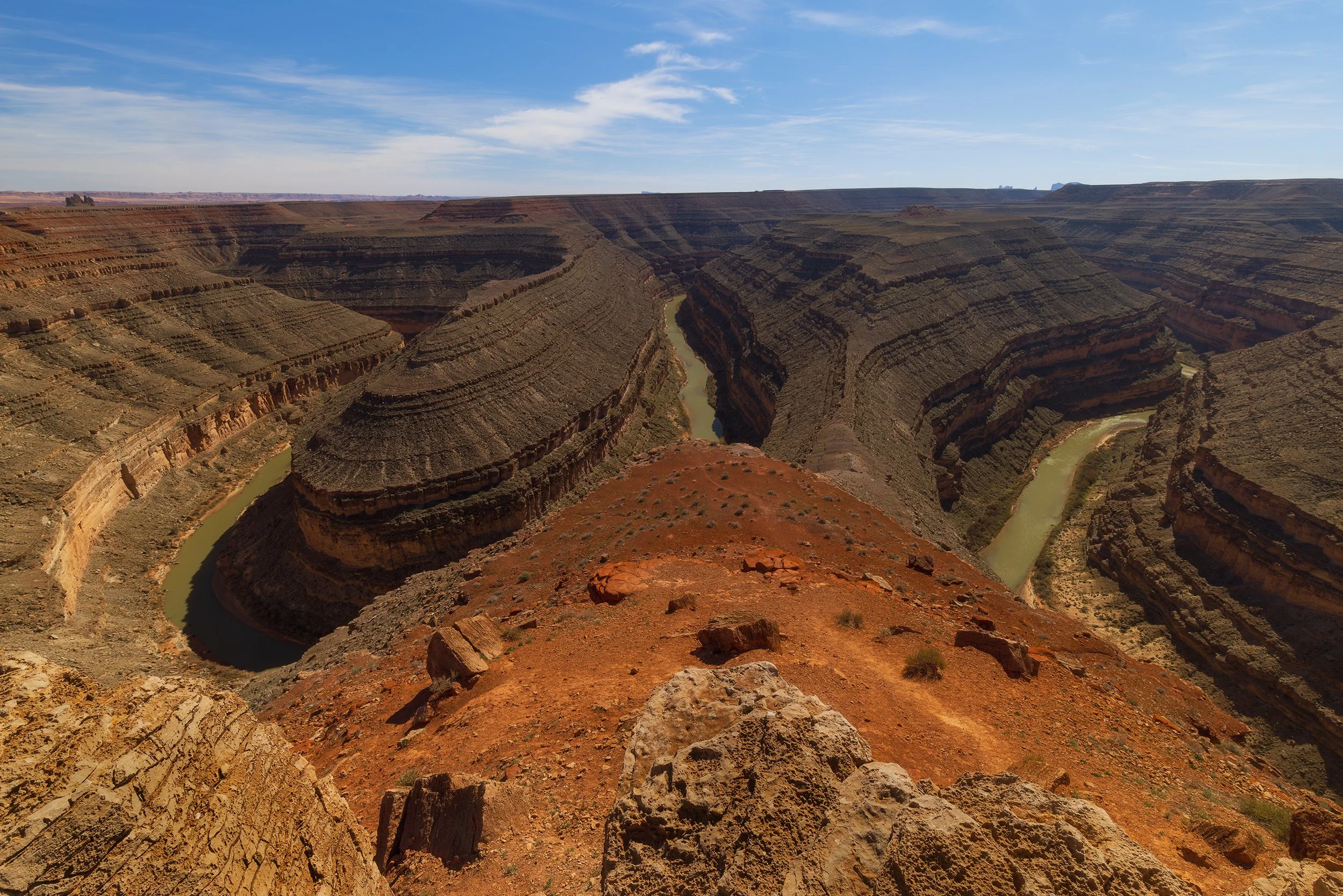
In an effort to kill more time before sunset, we then traveled onto Goosenecks State Park. This spot is surreal - the San Juan River carves a series of deep, 1,000-foot meanders that look like a giant snake's path frozen in stone.
Canon EOS R5, 17 mm | 1/100 sec., f/16, ISO 160
We ended the day at Monument Valley. Standing on this land, you realize why it is sacred to the Navajo (Diné). It isn't just a "cool backdrop" for a western movie. There is a palpable, heavy energy in the silence between those red mittens. It feels like the earth is holding its breath. As the last light hit the buttes, turning them a deep, bruised orange, I swapped between the 16-35mm and 24-105mm, trying to capture not just the light, but the reverence of the place.
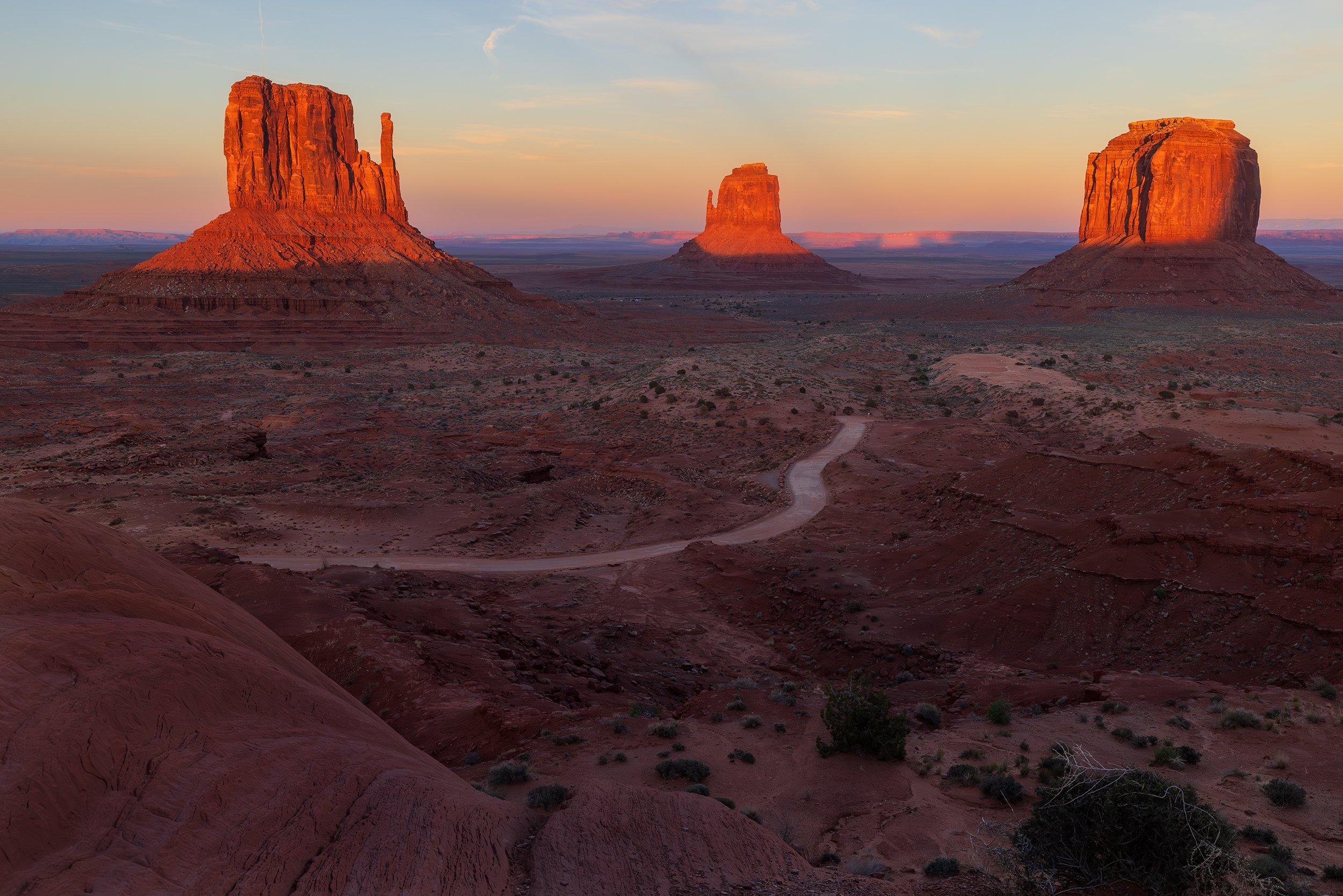
Canon EOS R5, 35 mm | 1/60 sec., f/11, ISO 1250
Day 3: The Price of the Shot
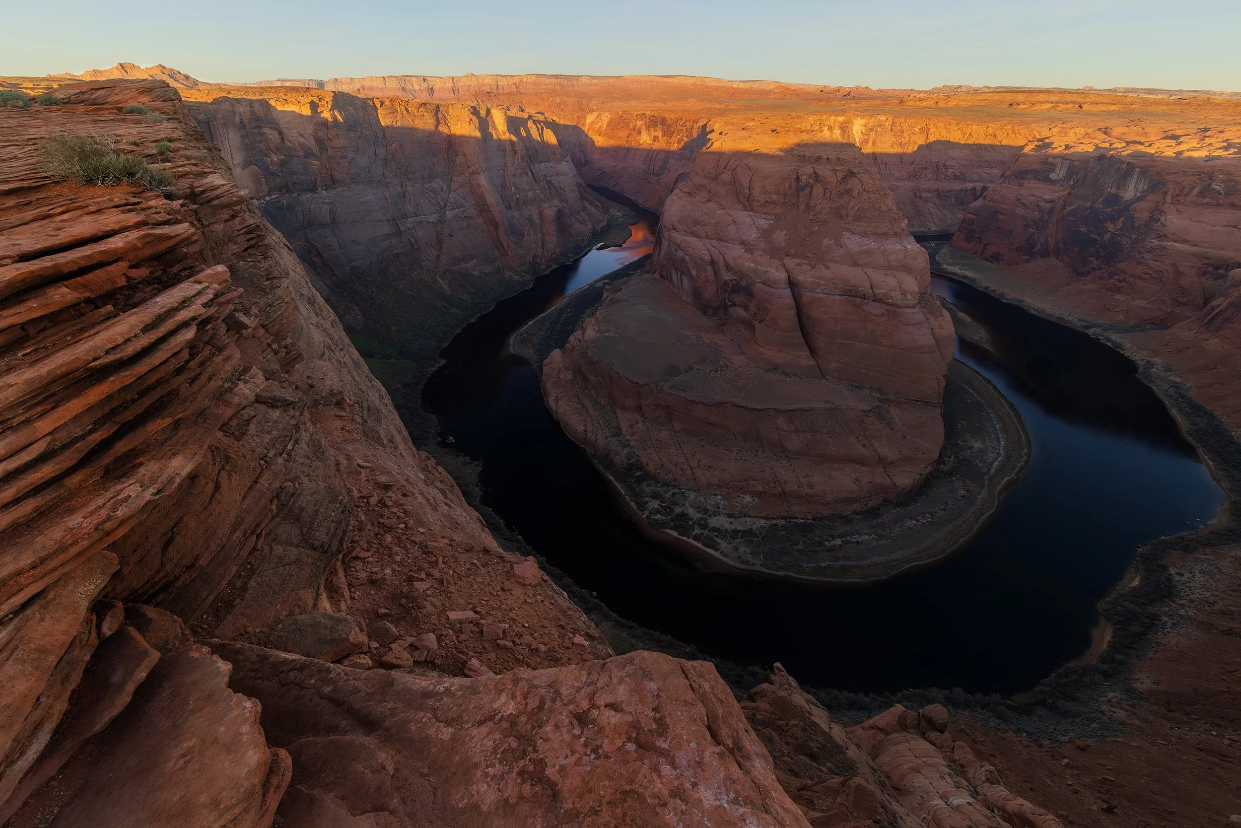
Horseshoe Bend at sunrise is less of a cliché than at sunset, but still a cliché nonetheless. And clichés exist for a reason. While the river below stayed in a deep, emerald shadow, the sun’s first rays ignited the rim in a violent orange.
Canon EOS R5, 16mm | 1/80 sec., f/16, ISO 1600
The cost? A sprained ankle. In the rush to find a composition among the jagged rocks, my foot gave way. After sitting for a few moments, I was able to get back up and put weight on it once again. We slowly made our way back to the car, fueled ourselves with a McDonald's breakfast, and maintained a stubborn refusal to let a joint injury end a trip on day three.
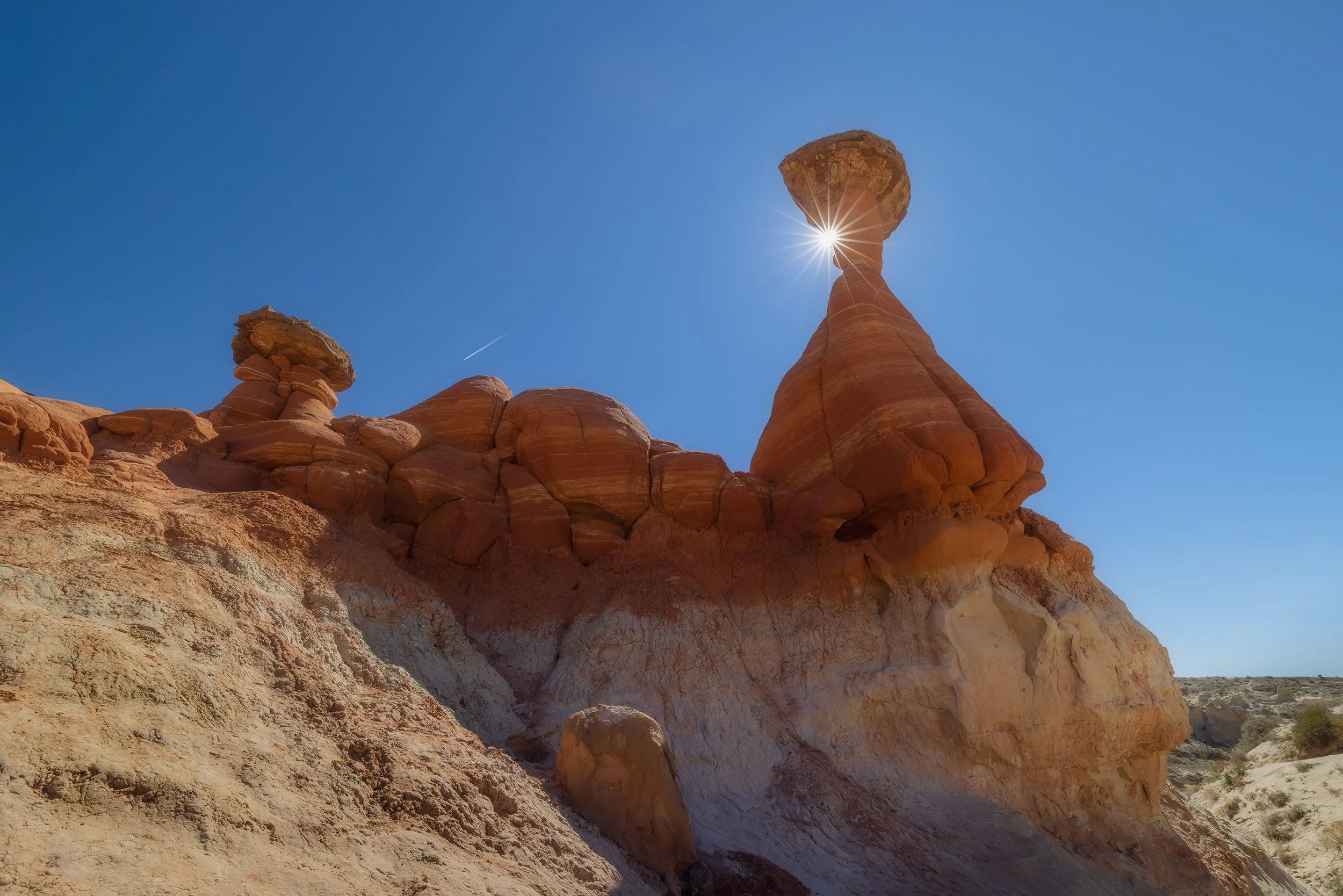
We retreated to Toadstool Hoodoos, a spot we first saw in 2021. But the "magic" was different this time. A massive heat dome - a symptom of a winter that never quite showed up here in the West - had pushed March temperatures into record highs. The sky was a flat, searing blue. I managed to tuck a sunstar behind a hoodoo for some visual interest, but the heat eventually drove us back to the trailhead.
Canon EOS R5, 16mm | 1/40 sec., f/16, ISO 100
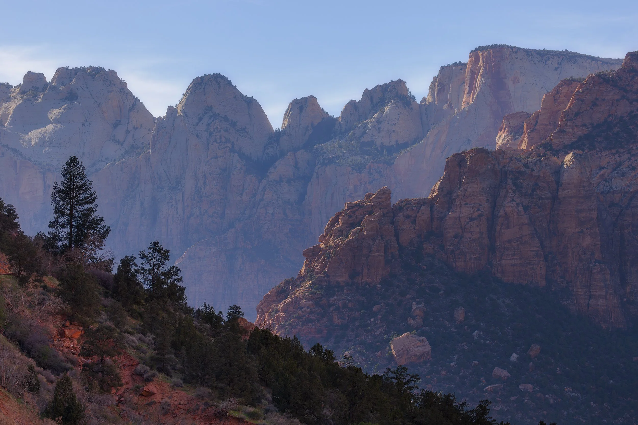
Zion: The Heat and the Crowd
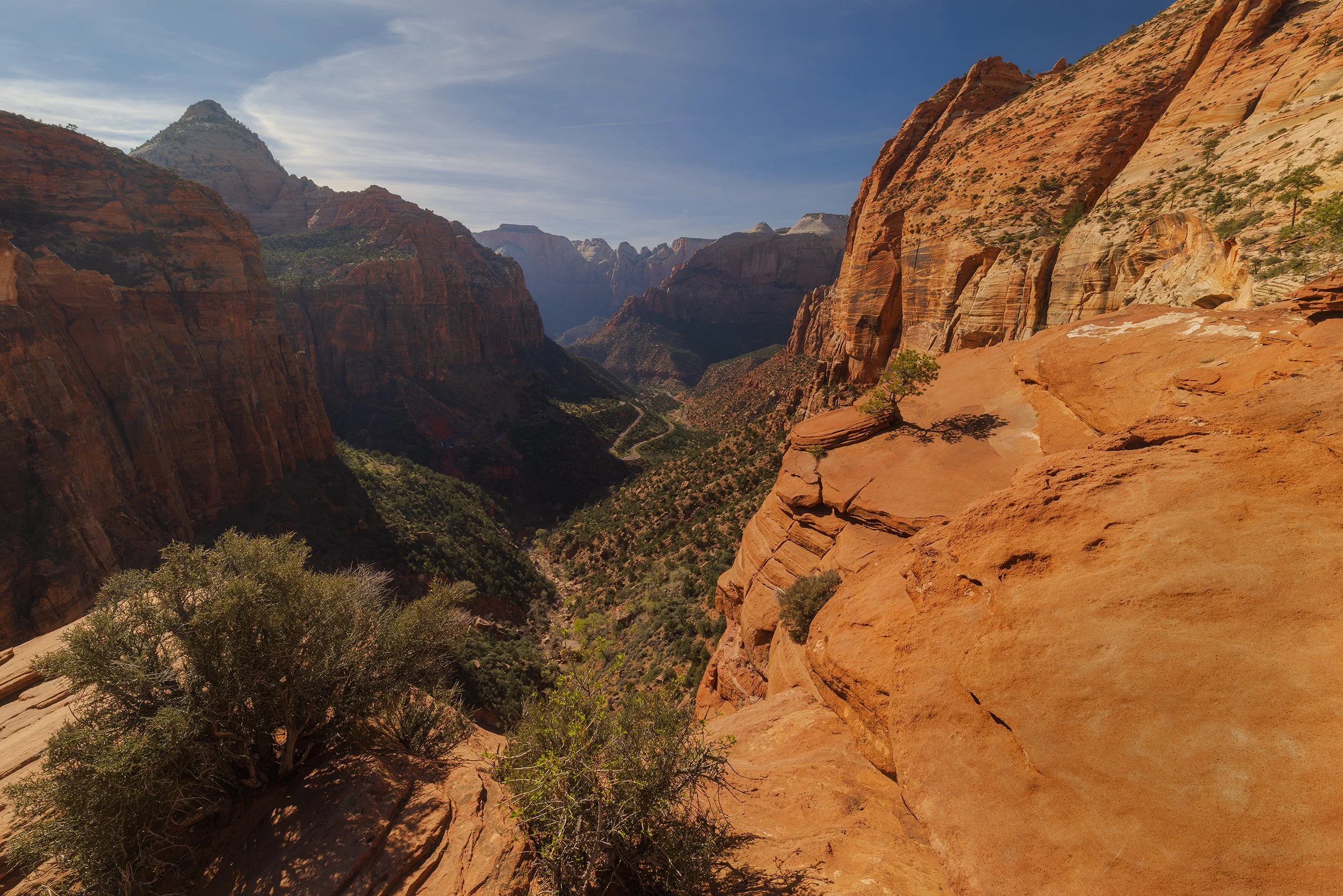
Zion National Park was a different kind of struggle. I’ll be blunt: Zion has become a theme park. Between the crowds chasing selfies and the commercialized hum of Springdale, the "soul" of the place felt buried. I had originally planned to hike the East Mesa Trail to Observation Point, but with the searing mid-day heat and my ankle pain still quite present, we had to pivot. A 7-mile round trip hike on a bad joint was a recipe for disaster.
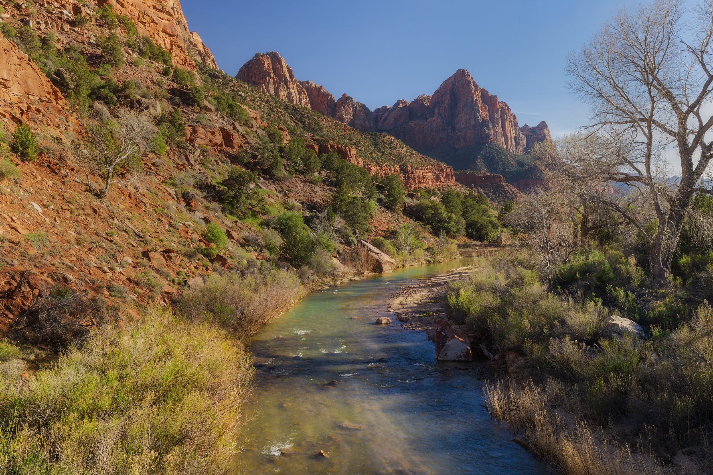
Instead, we hit the Canyon Overlook Trail. It’s short and shaded, but even then, I managed to roll the same damn ankle on the way down. It’s hard to find a "profound" moment when you're battling boring skies and dodging tourists in boutique hiking gear who seem more interested in the park sign than the Virgin River. After a quick stop along the Pa’rus trail, we ended up retreating to Cedar City for some Hawaiian food and an ice pack that was doing more work than my tripod.
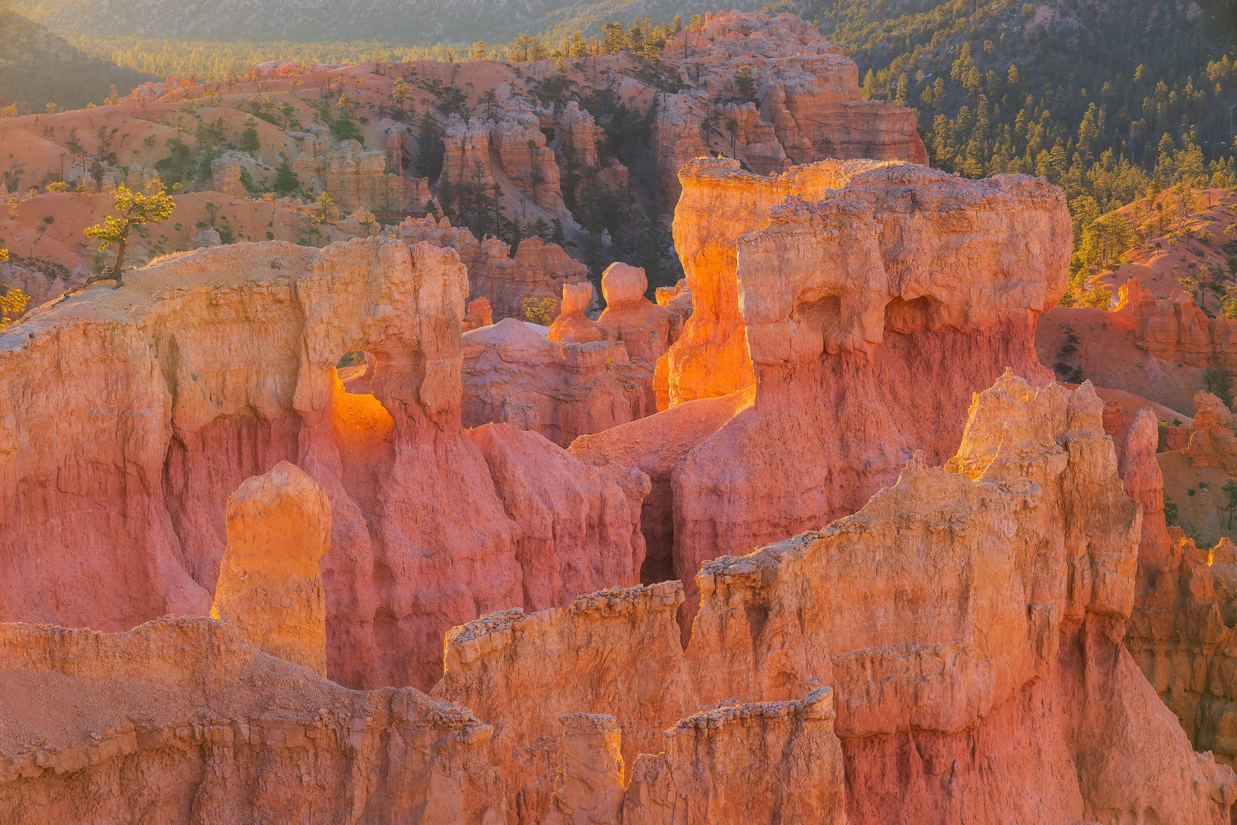
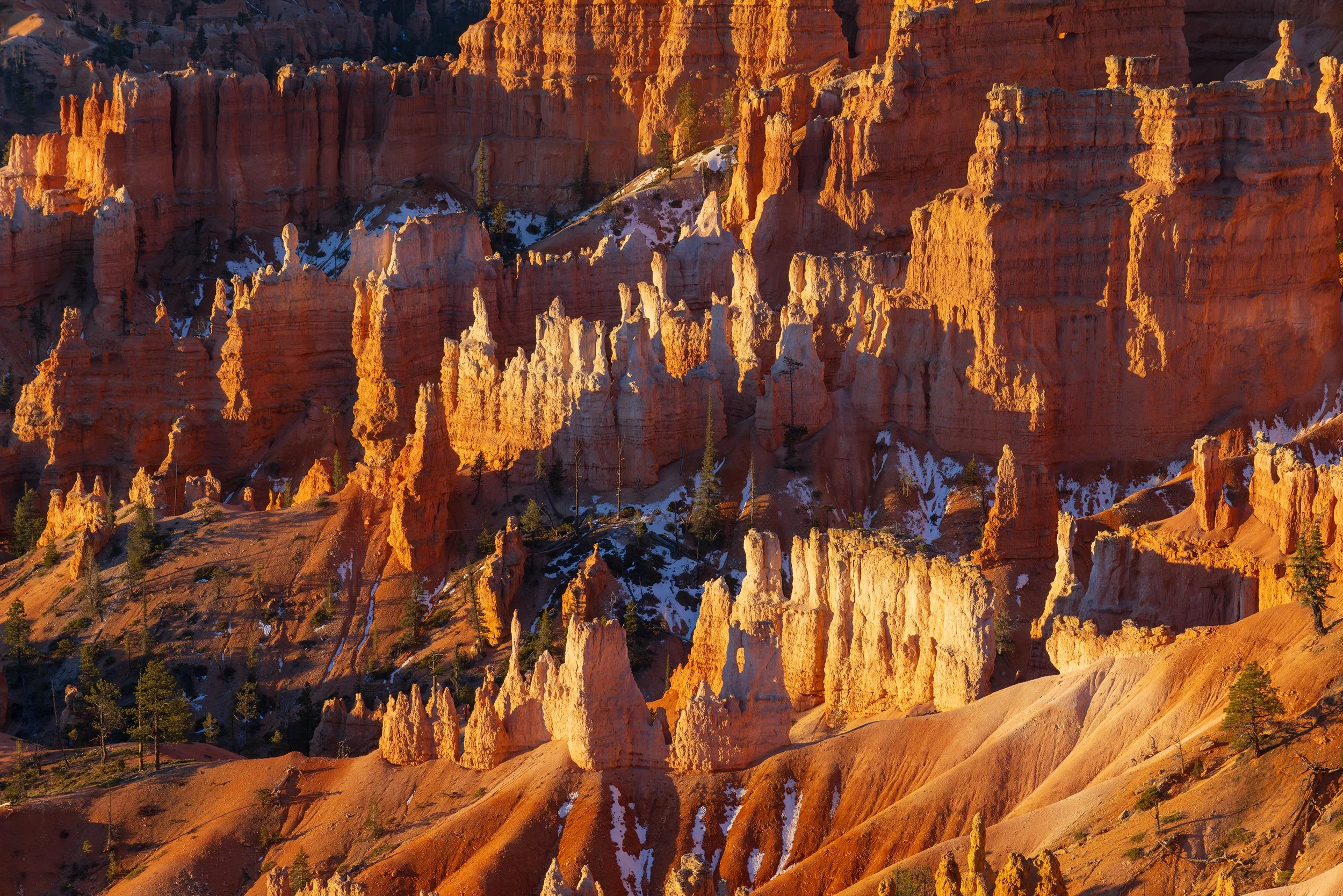
Day 4: The Hoodoo Glow and the Bird's Eye Perspective
4AM. The drive from Cedar City to Bryce Canyon was a stark contrast to the daytime heat. We wound through the dark, rural canyons in total solitude, the thermometer dipping to 19°F as we drove through the town of Panguitch.
When we arrived at the park, the parking lot was already a shark tank of rental SUVs (which are easily identifiable by the red Colorado plates and hipster Californians getting out). We bypassed the main clusters at Sunrise Point and found a secluded ledge.
Waiting for the sun to peak over the horizon and feeling the chill in the air was like a reset button. The wind blowing, the pockets of snow hiding in the hoodoos and canyons, made me realize why I get up early to experience these places. Because despite the crowds and tourists, they are still beautiful. A common phrase throughout this trip was things are beautiful in their own, unique way. While this applied to some scenes more than others, I couldn't help but respect that quiet moment, reflecting on that lookout of those golden orange hoodoos.
When the sun did finally come up, I didn't shoot directly at it; rather, I shot the glow. When that 7AM light hits the hoodoos, they don't just reflect light... they seem to generate it.
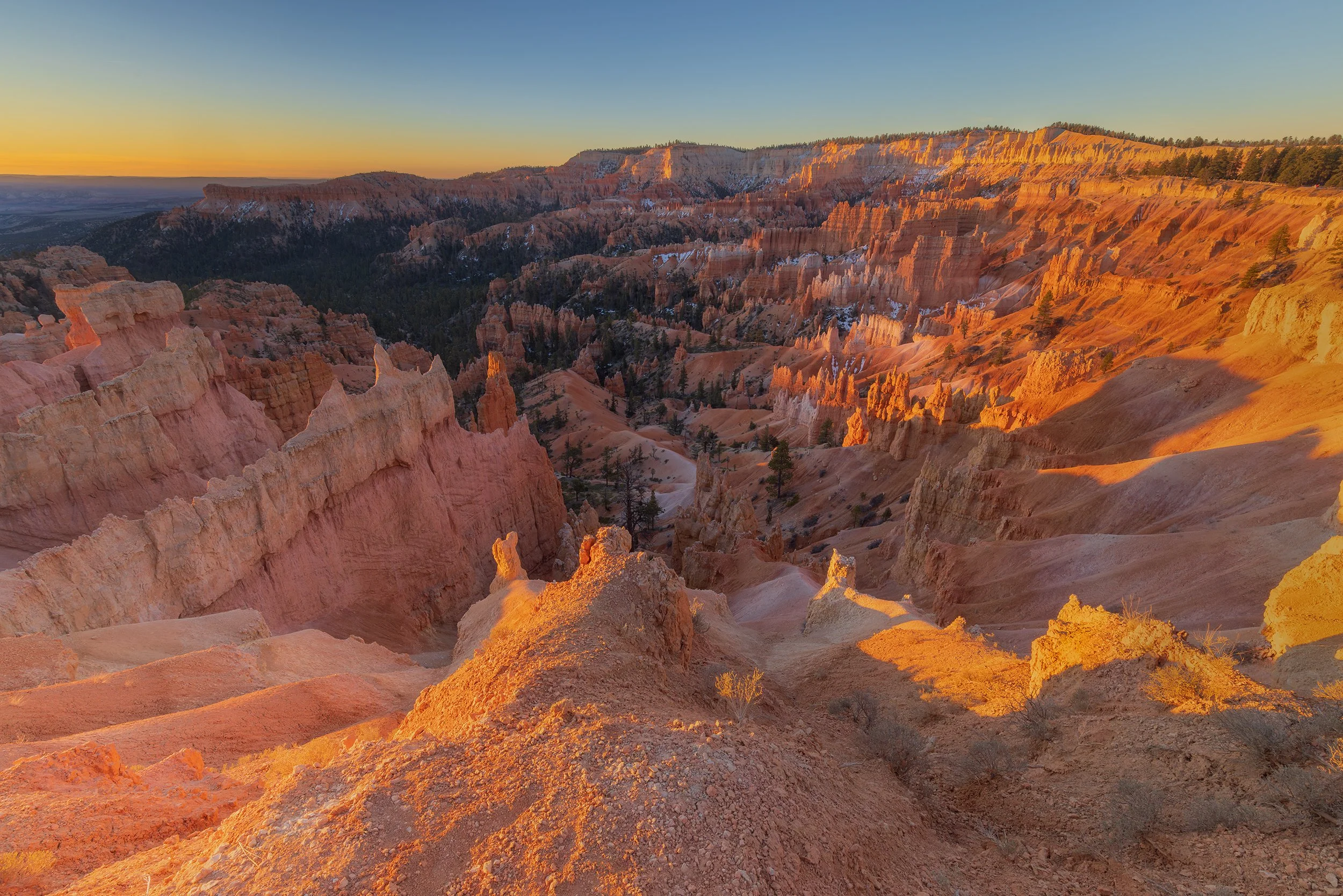
Canon EOS R5, 16mm | 1/3 sec., f/13, ISO 400
You might be asking yourself: what is a Hoodoo? They are geological totems - pillars of rock created by "differential erosion." For millions of years, the freeze-thaw cycles (frost wedging) and acidic rainwater have carved the Claron Formation into these whimsical, precarious towers.
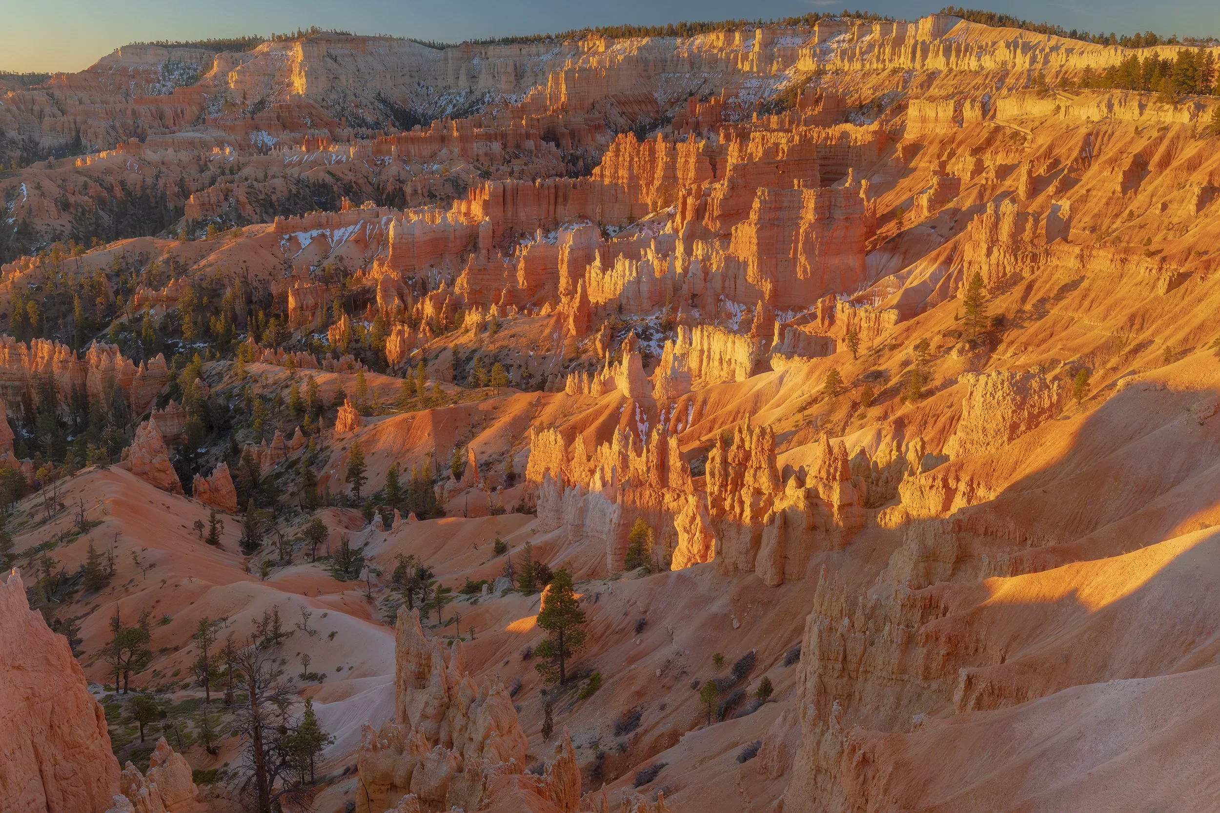
After the sunrise, we decided to take on a grueling hike through the Navajo and Queens Garden loops (despite the ankle). And once the heat and crowds continued to rise, we decided it was time to continue on. We took the scenic route through Escalante, where the drone spotted a hidden waterfall plummeting into a canyon - a scene invisible from the road.
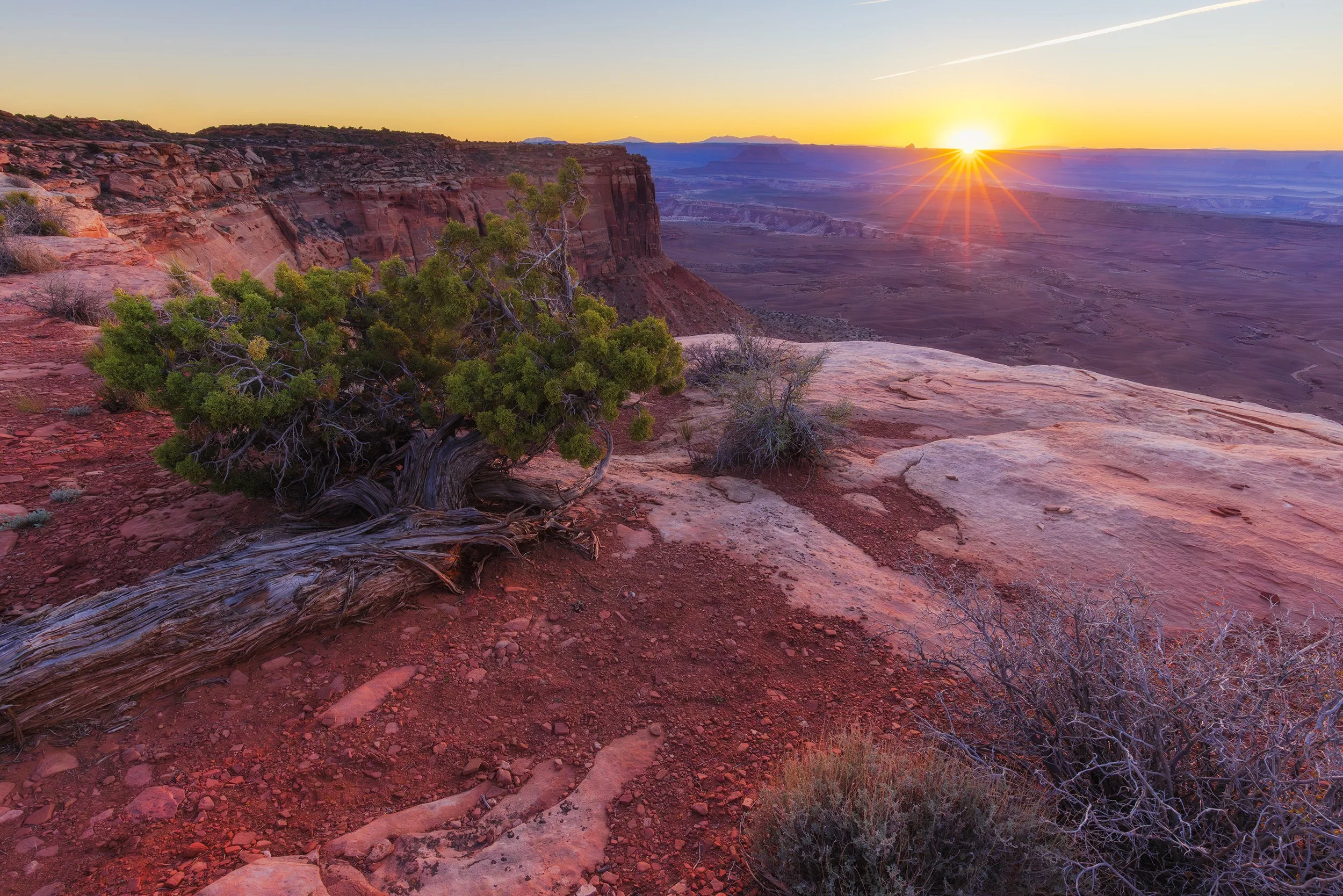
Day 5: Solitude on the Moon
3AM. No crowds. No gift shops. Just the dark winding road through Capitol Reef National Park through some of the most remote areas in Utah towards Moon Overlook. The last time I tackled this road, I was in a 2008 CR-V, and it was a white-knuckle struggle. This time, in my off-road modified CX-50, the rugged terrain felt like a victory lap.
This area of Utah is an International Dark Sky Park. Because of the high elevation, low humidity, and total lack of light pollution, these are some of the darkest skies on the continent. Standing there in the pitch black, the Milky Way isn't just a faint smudge; it’s a structural entity.
The Feeling of the Void
There is a profound, heavy silence that exists in the desert at 5AM. Standing there, you don't just see the stars; you feel the weight of them. With the Benro Polaris humming quietly, tracking a galaxy thousands of light-years away while I stood on a rim of bentonite clay, the scale of it all becomes almost overwhelming. You realize you aren’t just taking a photo of the sky; you’re documenting a slice of time that makes our entire human history look like a rounding error.
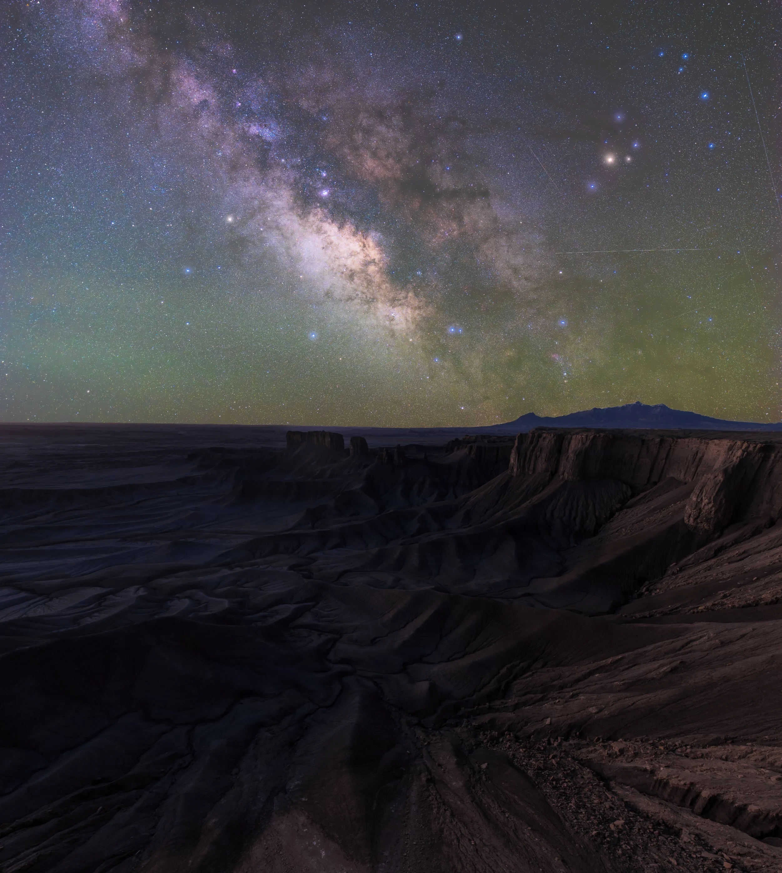
Technical Dive: The Star Tracker
The Benefit: A tracker moves your camera at the exact speed of the Earth’s rotation. This allows me to take a 3-minute exposure at a low ISO without getting "star trails" (blur).
The Process: I capture the stars with the tracker, then wait for "blue hour" to capture the foreground (the ground). This was done a bit of a drive further to the actual overlook. Blending these later creates a crisp, noise-free image that reflects exactly what the human eye wishes it could see in the dark.
Sky: Canon EOS R5, 16mm | 106 sec., f/4, ISO 1600
Foreground: Canon EOS R5, 16mm | 0.8 sec., f/11, ISO 1250
Standing on the Edge of the Blue Valley
Moon Overlook isn't just a name; it’s a geographical literalism. Standing on the crumbling rim of the Blue Valley, you are looking down at a landscape of Mancos Shale - a grey, fragile seafloor from the Cretaceous period that has spent millions of years eroding into a labyrinth of sharp ridges and deep, shadowed basins. It is colorless, hostile, and utterly mesmerizing. In the pre-dawn light, without the distraction of vegetation or soil, the earth looks naked. It’s a place that feels less like a landscape and more like a physical manifestation of silence.
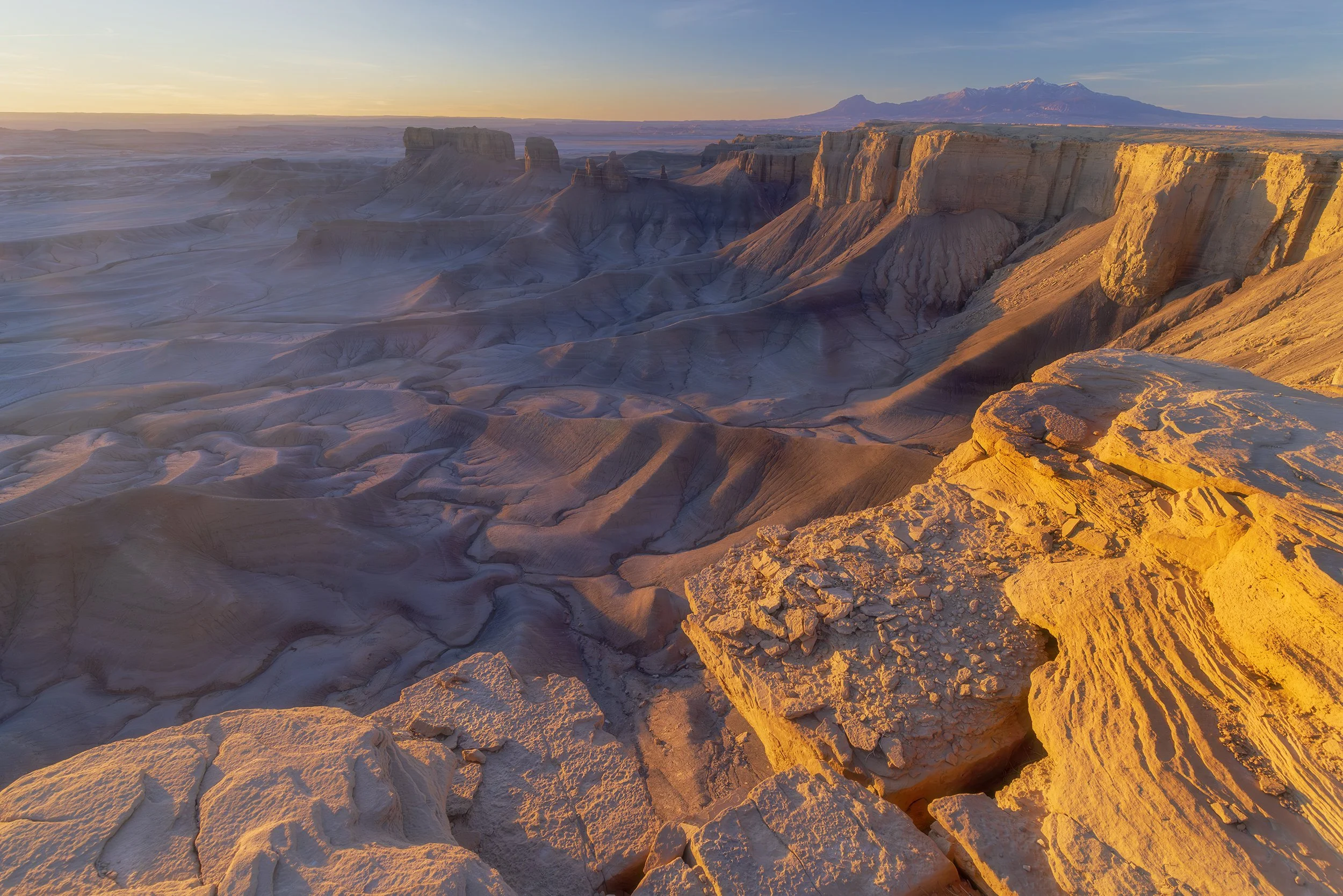
Looming in the distance are the Henry Mountains, a jagged skyline that holds a unique place in American history. They were the last mountain range in the lower 48 states to be officially mapped and named. Today, they remain one of the most remote places in the West. Seeing those snow-capped peaks rising out of the grey, lunar desert of the overlook creates a visual dissonance that’s hard to wrap your head around. It is, quite simply, one of the most otherworldly vistas in the American West.
Canon EOS R5, 16mm | 1/60 sec., f/13, ISO 1250
The Icon: Factory Butte
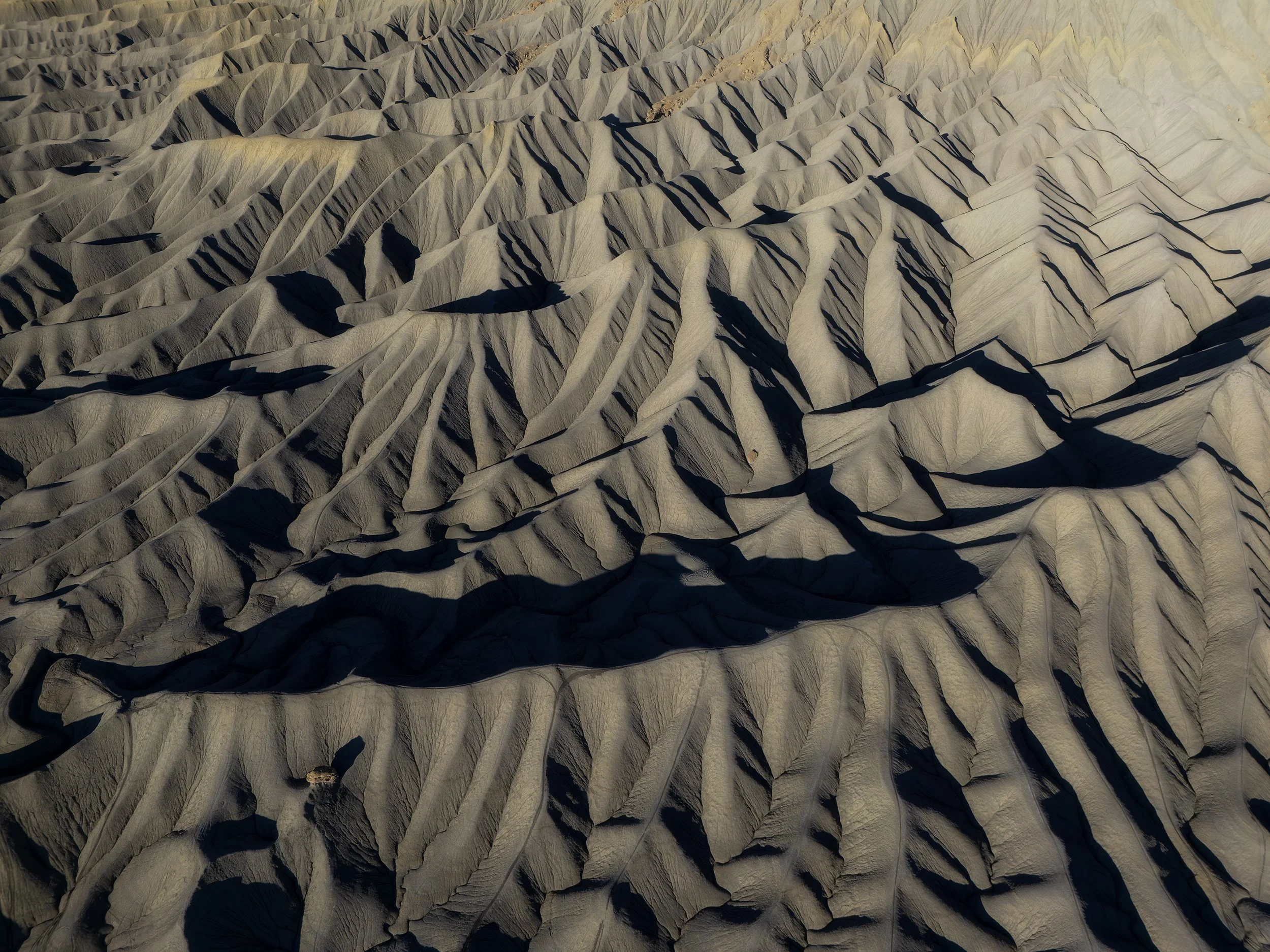
As the sun rose, I backtracked to Factory Butte. This monolith of Mancos Shale is a mecca for photographers because of its dramatic "fins" and the way it rises out of the desert floor like a cathedral. I flew the drone here, capturing the early morning light as it raked across the badlands below. Here is one of the scenes I was able to see.
DJI Air 3, 7mm | 1/4000 sec., f/1.7, ISO 100
The Painted Badlands: Bentonite and Spires
Before leaving the Hanksville area, we detoured into the Bentonite Hills and sought out the lonely silhouette of the Long Dong Silver spire. If Moon Overlook felt like the edge of the world, this felt like the surface of Mars. The Bentonite Hills are part of the Jurassic-aged Morrison Formation - essentially ancient volcanic ash that settled into thick layers of clay. Over millions of years, these layers mineralized into vibrant bands of deep red, purple, and blue. Walking on them is a tactile experience; the clay has a "popcorn" texture that crunches under your boots, a result of the bentonite expanding when wet and shrinking as it bakes in the desert sun.
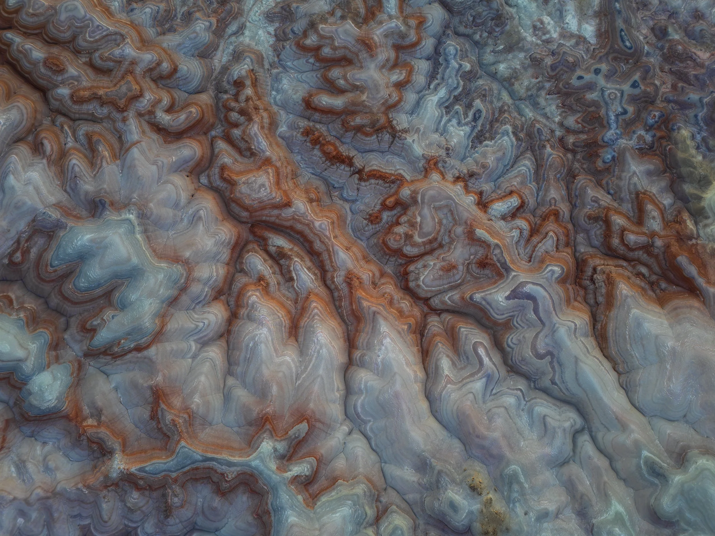
DJI Air 3, 7mm | 1/50 sec., f/1.7, ISO 100
Nearby, the Long Dong Silver spire rises out of the grey, desolate badlands like a jagged needle. It’s a solitary remnant of erosion, a towering pillar of Entrada Sandstone that has somehow survived while the landscape around it was stripped away by wind and flash floods. Flying the drone here is a necessity to truly grasp the scale; from the air, the spire looks like a monument to loneliness, surrounded by the swirling, monochromatic ripples of the desert floor. These landscapes aren’t "pretty" in the traditional sense - they are raw, jagged, and indifferent to human presence, which is exactly why they are a mecca for anyone trying to capture something that feels truly primordial.
We finished the morning in Capitol Reef with a history lesson and a pie. The park’s orchards were planted by Mormon pioneers in the 1880s; eating a fresh pie in a desert canyon is a surreal bridge between human history and geological time. Once we finished admiring the blooming desert orchard, we pushed on to Moab.
Day 6: The Pivot to Dead Horse
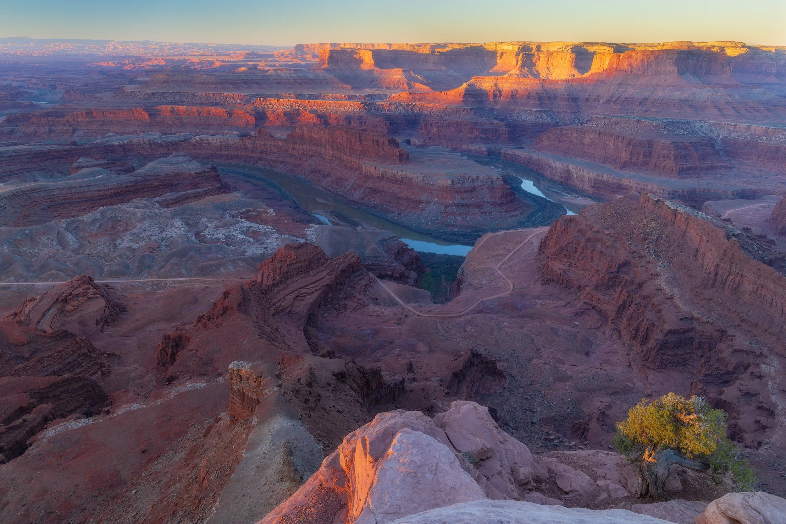
We were running late for our Marlboro Point sunrise, so we made a tactical decision to hit Dead Horse Point State Park instead. I set up with the 16-35mm, pointing away from the sun to watch the light strike the canyon walls.
Canon EOS R5, 24mm | 1/30 sec., f/11, ISO 800
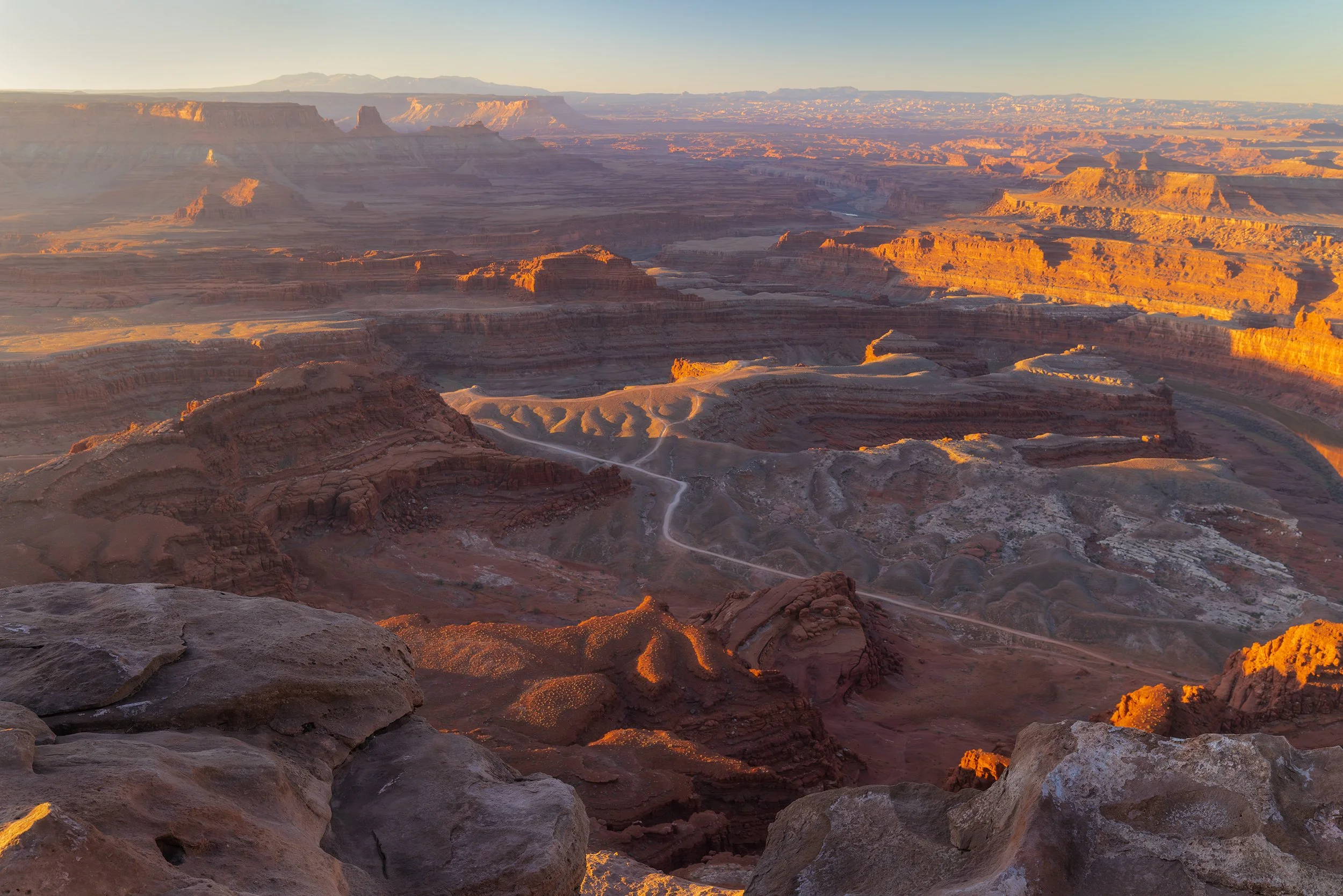
Canon EOS R5, 35 mm | 1/40 sec., f/11, ISO 800
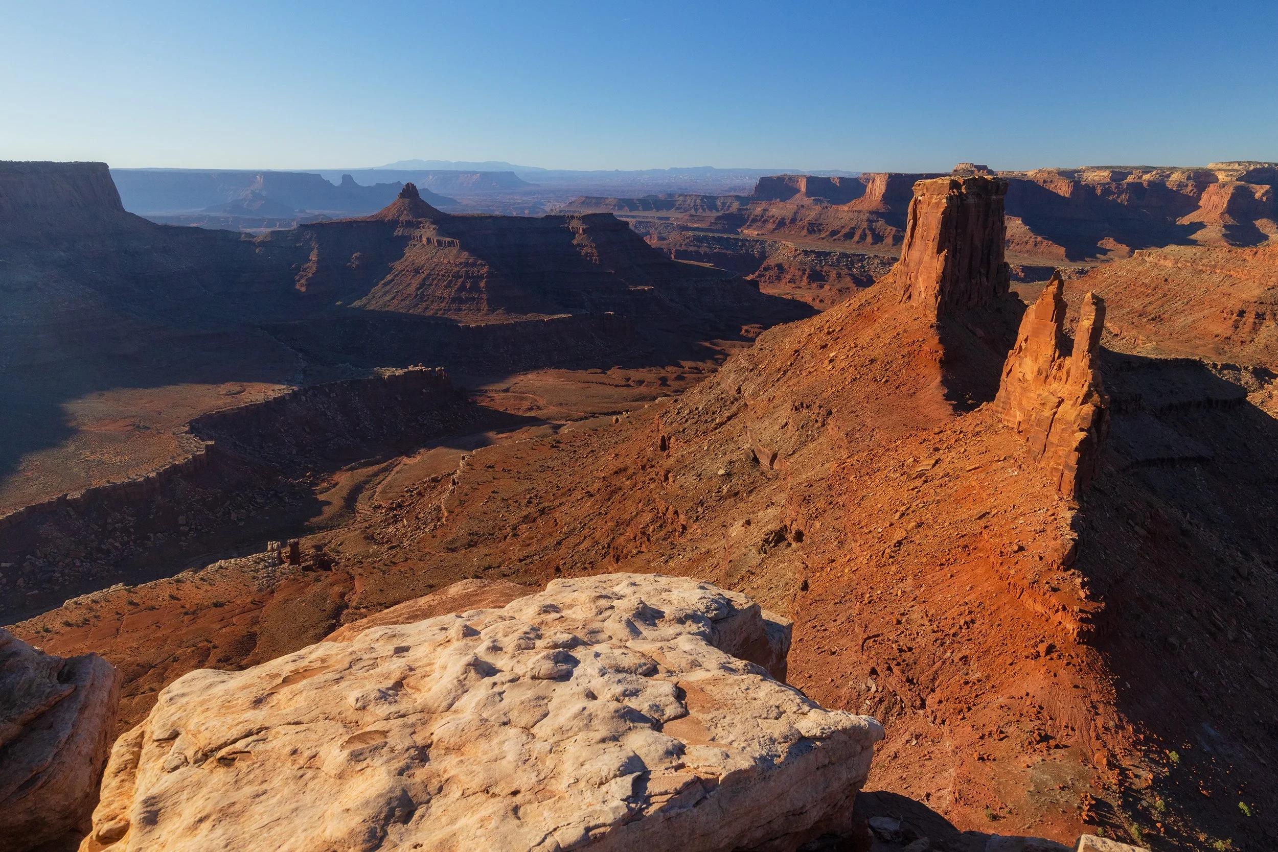
Later, we finally made it to Marlboro Point - the famous backdrop of old cigarette commercials. The road was rocky and washed out, but the CX-50 handled it with ease. Unfortunately, the sun was well risen by the time we arrived, and there wasn’t a cloud in the sky. However, I can happily say we were the only brave souls who ventured out to this remote location.
Canon EOS R5, 20mm | 1/640 sec., f/13, ISO 1000
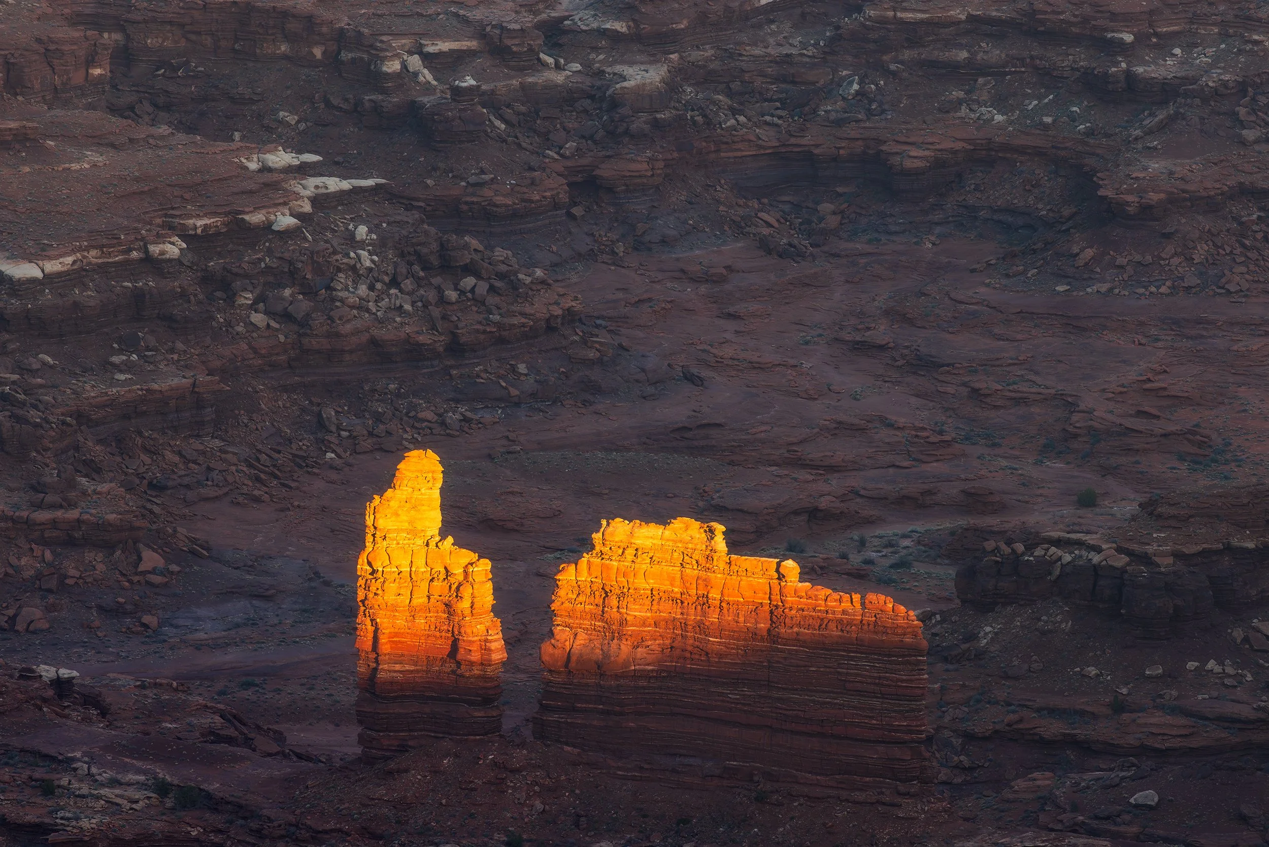
After an afternoon relaxing in Moab, we ventured back to Canyonlands National Park and scouted for sunset locations. I used the 100-400mm to zoom into details at Grand View Point, and watched as the light danced off the canyons below.
I then made another quick pivot to Orange Cliffs overlook and hiked down to a large ledge. A weathered pinyon pine served as a great foreground with the canyons and setting sun as the background. I utilized the 16-35mm for these shots, enjoying being able to capture the full range of the scene. As the sun set over Canyonlands, a wildfire burned far in the distance. The air wasn't thick with smoke, but you could see the plume caught in the golden hour light - a grim reminder of how dry this "bluebird" winter has been.
Canon EOS R5, 17mm | 1/60 sec., f/16, ISO 1000
Day 7: Arches and the Road Home
We planned for a Delicate Arch sunrise, but the sleep deprivation won out. We pivoted to the Windows Section, hoping for a shot of Turret Arch framed by the North Window.
The Pivot within the Pivot: When we arrived, 20 people were already camping in the arch. My shot was gone. I flexed, finding a pull-off near the Garden of Eden where I could line up Turret Arch with the snow-capped La Sal Mountains. It wasn't the shot I planned, but it was a better shot because it was mine, not a recreation of a postcard.
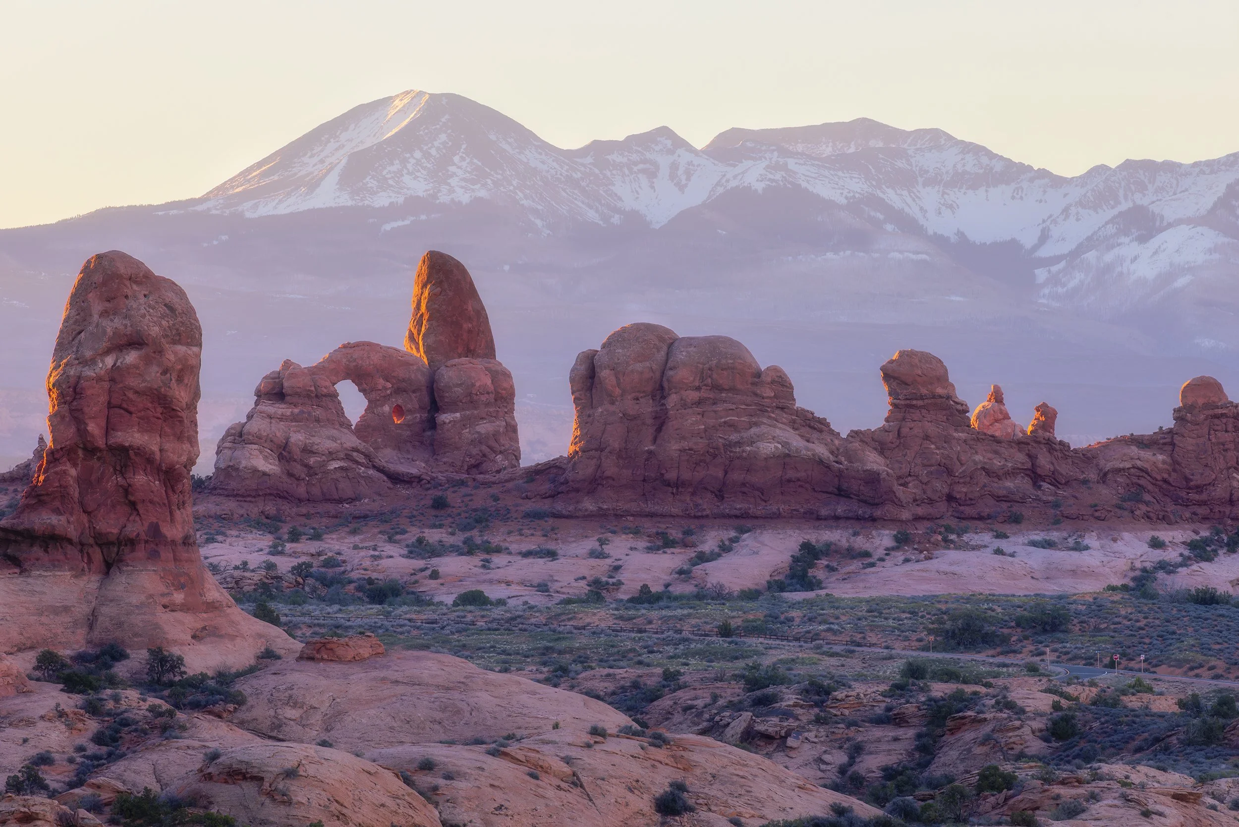
Canon EOS R5, 300mm | 1/100 sec., f/13, ISO 640
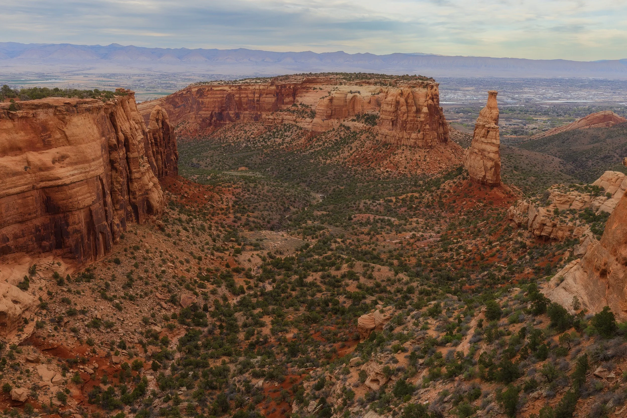
After a quick hike to Landscape Arch, the desert sun became unbearable. We left Arches early, heading back into Colorado. We stopped in Palisade - for our favorite ritual of winery-sitting and local pies - before one final afternoon stop at Colorado National Monument's Independence Monument Overlook.
Canon EOS R5, 35mm | 1/100 sec., f/13, ISO 640
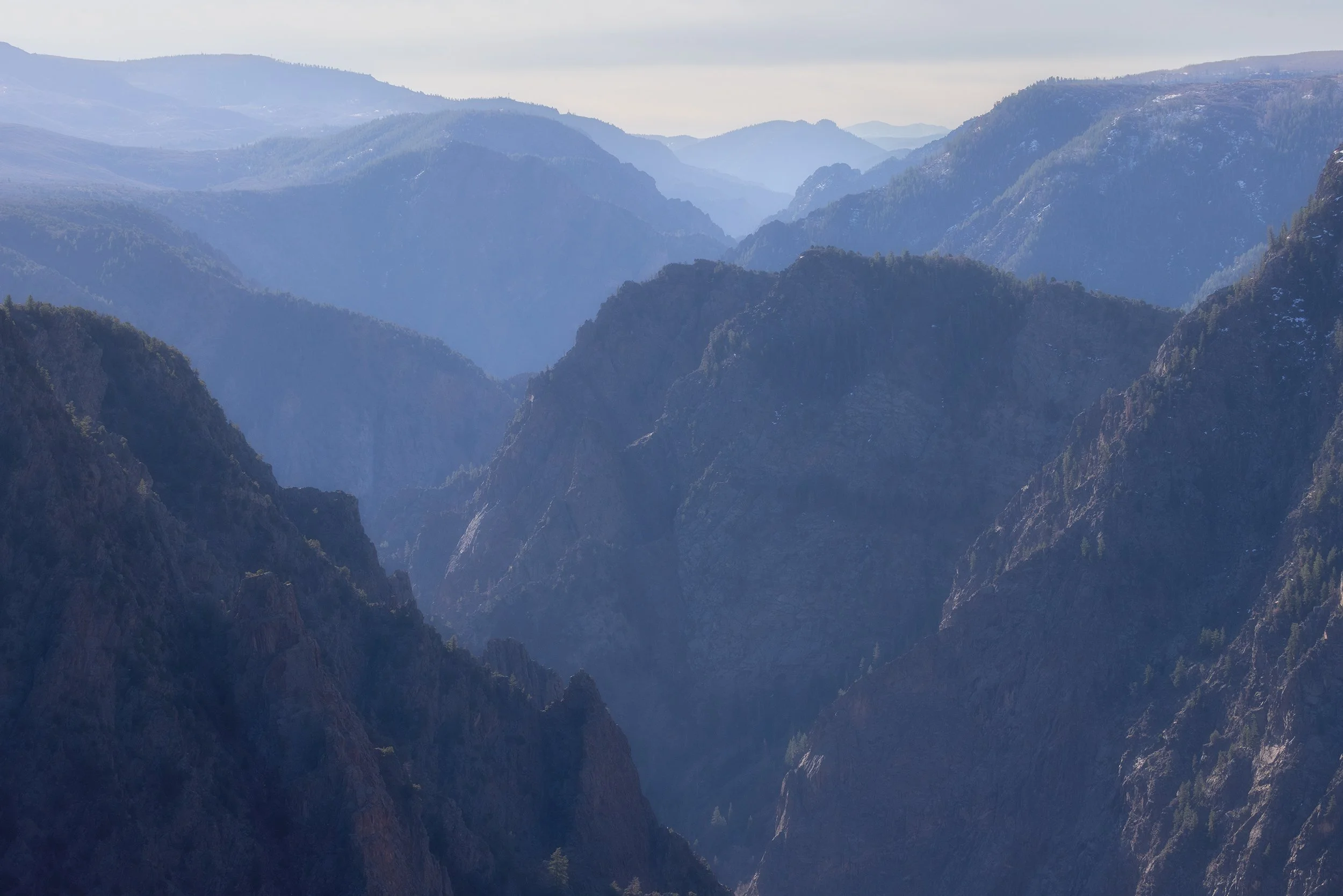
The trip ended at the Black Canyon of the Gunnison National Park. We finally got our passport stamp at the visitor center - a small victory after a government shutdown thwarted our last attempt. Standing at Tomichi Point, looking down into the 2,000-foot vertical drop of the Precambrian rock, I realized that while the skies were blue and the ankles were bruised, the trip was exactly what it needed to be.
Canon EOS R5, 100mm | 1/500 sec., f/13, ISO 640
Closing Thoughts
Landscape photography is often sold as a series of "epic" moments captured in perfect light, but the reality is a week of bluebird skies, a twice-sprained ankle, and fighting for a parking spot at 5AM. But that’s the point. The "perfect" shot is rarely about the weather; it’s about the resilience required to find something meaningful when the conditions are working against you. The desert doesn't owe you a sunset, and it certainly doesn't care about your portfolio. It just is. And sometimes, being there to witness that indifference is the most profound part of the journey.
What's your biggest "photography nightmare" on a trip?
Let me know in the comments below!